Marydel in Caroline County, Maryland — The American Northeast (Mid-Atlantic)
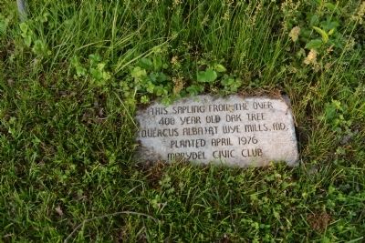
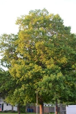
Sapling from 400 Year Old Oak Tree
400 year old oak tree
(quercus alba) at Wye Mills, MD.
Planted April 1976
Erected by Marydel Civic Club.
Topics. This historical marker is listed in this topic list: Horticulture & Forestry. A significant historical date for this entry is April 26, 1976.
Location. 39° 6.761′ N, 75° 44.727′ W. Marker is in Marydel, Maryland, in Caroline County. Marker can be reached from the intersection of Crown Stone Road (Maryland Route 454) and Fire House Lane. Touch for map. Marker is at or near this postal address: 303 Firehouse Lane, Marydel MD 21649, United States of America. Touch for directions.
Other nearby markers. At least 8 other markers are within 8 miles of this marker, measured as the crow flies. Mason-Dixon Crownstone (a few steps from this marker in Delaware); West Dover Hundred (within shouting distance of this marker in Delaware); Thomas' Chapel (approx. 2.4 miles away in Delaware); Cow Marsh Primitive Baptist Church (approx. 5.6 miles away in Delaware); Cheney Clow's Rebellion (approx. 6.1 miles away in Delaware); Samuel D. Burris (approx. 6.9 miles away in Delaware); St. Andrew's Chapel, 1880 Sudlersville, MD (approx. 7.9 miles away); Sudlersville Train Station (approx. 7.9 miles away). Touch for a list and map of all markers in Marydel.
More about this marker. This marker is very close to the Delaware state line, where Maryland route 454 becomes Delaware route 8 (Halltown Road).
Credits. This page was last revised on March 15, 2021. It was originally submitted on May 20, 2014, by Tom Fuchs of Greenbelt, Maryland. This page has been viewed 621 times since then and 31 times this year. Last updated on March 9, 2021, by Carl Gordon Moore Jr. of North East, Maryland. Photos: 1, 2. submitted on May 20, 2014, by Tom Fuchs of Greenbelt, Maryland. • Bill Pfingsten was the editor who published this page.

