St. Simons Island in Glynn County, Georgia — The American South (South Atlantic)
The Town Wall
Fort Frederica National Monument
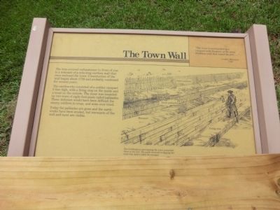
“The town is surrounded by a rampart with flankers, of the same thickness with that round the fort…” London Magazine 1745
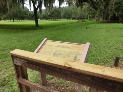
The tree-covered embankment in front of you is a remnant of a mile-long earthen wall that once enclosed the town. Construction of the wall began about 1739 and probably continued for several years.
The earthworks consisted of a sodden rampart 6 feet high, with a firing step on the inside and a moat on the outside. The moat was bounded by two rows of eight-foot posts called palisades. These defenses would have been difficult for enemy soldiers to cross, and none ever tried.
Today the palisades are gone and earth-works have been eroded, but remnants of the wall and moat are visible.
(caption)
The fortifications surrounding the town resembled those at the fort. The earth removed in digging the moat was used to build the rampart.
Erected by National Park Service, US Department of the Interior.
Topics. This historical marker is listed in these topic lists: Colonial Era • Forts and Castles • Settlements & Settlers. A significant historical year for this entry is 1745.
Location. 31° 13.416′ N, 81° 23.406′ W. Marker is on St. Simons Island, Georgia , in Glynn County. Marker can be reached from Mimosa Drive, 0.1 miles west of Frederica Drive, on the right when traveling west. The marker is on the grounds of the Fort Frederica National Monument. Touch for map. Marker is at or near this postal address: 6515 Frederica Drive, Saint Simons Island GA 31522, United States of America. Touch for directions.
Other nearby markers. At least 8 other markers are within walking distance of this marker. Broad Street (a few steps from this marker); Frederica (a few steps from this marker); The Defender (a few steps from this marker); The Flesh Market (a few steps from this marker); Shoemaker and Soldier (within shouting distance of this marker); Tavernkeepers (within shouting distance of this marker); Frederica - Huts and Houses (within shouting distance of this marker); Fort Frederica (within shouting distance of this marker). Touch for a list and map of all markers in St. Simons Island.
Also see . . . Fort Frederica National Monument. (Submitted on November 14, 2013.)
Credits. This page was last revised on November 25, 2020. It was originally submitted on November 14, 2013, by Don Morfe of Baltimore, Maryland. This page has been viewed 438 times since then and 10 times this year. Last updated on May 21, 2014, by Keith S Smith of West Chester, Pennsylvania. Photos: 1, 2. submitted on November 14, 2013, by Don Morfe of Baltimore, Maryland. • Bill Pfingsten was the editor who published this page.

