Near Madera Canyon in Santa Cruz County, Arizona — The American Mountains (Southwest)
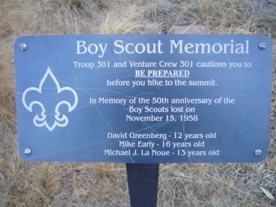
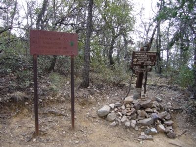
Boy Scout Memorial
Be Prepared
before you hike to the summit.
In memory of the 50th anniversary of the
Boy Scouts lost on
November 15, 1958
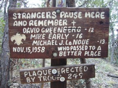
David Greenberg – 12 years old
Mike Early – 16 years old
Michael J. La Noue – 13 years old
Erected 2008 by Troop 301 and Venture Crew 301.
Topics. This historical marker and memorial is listed in these topic lists: Disasters • Notable Events. A significant historical month for this entry is November 1934.
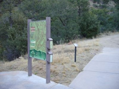
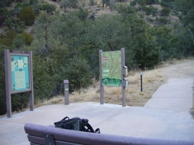
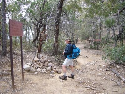
Location. 31° 42.807′ N, 110° 52.396′ W. Marker is near Madera Canyon, Arizona, in Santa Cruz County. Marker can be reached from Madera Canyon Road. Marker is in the northeast corner of the Madera Canyon Picnic area parking lot, at the Super Trail Trailhead. Touch for map. Marker is in this post office area: Green Valley AZ 85614, United States of America. Touch for directions.
Other nearby markers. At least 8 other markers are within 13 miles of this marker, measured as the crow flies. Camp Crittenden (approx. 11 miles away); Baca Float Number 3 (approx. 12.4 miles away); Tubac Presidio (approx. 12.4 miles away); Tubac Schools (approx. 12.4 miles away); Churches in Tubac (approx. 12.4 miles away); Presidio of Tubac (approx. 12.4 miles away); Juan Bautista de Anza (approx. 12.4 miles away); Charles Debrille Poston (approx. 12.4 miles away).
Regarding Boy Scout Memorial. On November 15, 1958, six Boy Scouts started off on a hiking adventure to climb to the top of the tallest mountain in Southern Arizona called "Old Baldy", in the Santa Rita Mountains, just South of Tucson. They ranged in age from 11 to 16. On the way up, the youngest tenderfoot Scout, Ronnie Sepulveda (11) developed blisters. In a kind gesture, 16 year old Louis Burgess took him and Ralph Coltrin (12) back to base camp. That action ultimately saved those three lives.
The weather unexpectedly worsened in the early evening, first with wind and rain and later with a heavy snowfall. It was the earliest and heaviest snow event on record in Tucson. Six inches of snow fell across the metro area causing auto accidents, stranded people, dropped power lines, knocked out telephone service, closed highways and paralyzed air travel. Several feet of snow fell on "Old Baldy".
The others died when Mike Early (16) made a wrong turn in the darkness and then tripped, apparently on a downed forest service line, falling 100 feet and breaking his leg.
The two younger scouts; David Greenberg (12) and Michael LaNoue (13) bravely climbed down that steep slope in the dark to find him. They stayed there making a campfire and using David’s hatchet built a crude branch covering. But, it was not enough for the “snowstorm of the century.”
They were not found until 19 days later after 750 sheriff deputies, hikers, scouts, ranchers, and military personnel spent grueling days and nights trying to find and save them.
After the boys were found, the searchers were inspired to quickly form the Southern Arizona Rescue Association. That organization has literally saved hundreds of lives in the last 50 years.
Also see . . .
1. "Death Clouds on Mt. Baldy". A review of the book written by Cathy Hufault and published by Arizona Mountain Publications which tells the true story about the heroes that participated in the largest search and rescue operation in Arizona's history. Includes historic photos. (Submitted on August 7, 2012.)
2. NPR Radio. A 14 minute radio presentation regarding the events of November 15, 1958. (Submitted on August 7, 2012.)
Photographed By Bill Kirchner, January 21, 2012
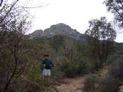
7. Hiker on Old Baldy Trail.
This is the trail the Boy Scouts used in 1958. Old Baldy is the highest peak in the Santa Rita Mountains, measuring in at 9453 feet. The trail is 5.0 miles to the summit, it is also the steepest and most strenuous with over 4100 feet of ascent.
Credits. This page was last revised on June 16, 2016. It was originally submitted on January 22, 2012, by Bill Kirchner of Tucson, Arizona. This page has been viewed 2,086 times since then and 106 times this year. Last updated on May 22, 2014, by Richard E. Miller of Oxon Hill, Maryland. Photos: 1, 2, 3, 4, 5, 6, 7. submitted on January 22, 2012, by Bill Kirchner of Tucson, Arizona. • Bill Pfingsten was the editor who published this page.
