Attalla in Etowah County, Alabama — The American South (East South Central)
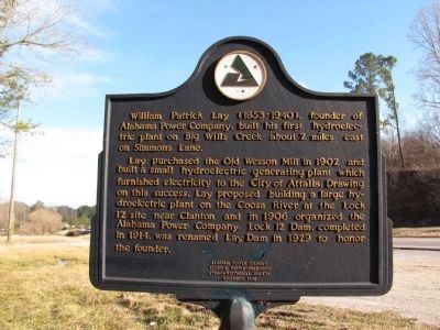
William Patrick Lay
(1853-1940)
Lay purchased the Old Wesson Mill in 1902 and built a small hydroelectric generating plant which furnished electricity to the City of Attalla. Drawing on this success, Lay proposed building a large hydroelectric plant on the Coosa River at the Lock 12 site near Clanton and in 1906 organized the Alabama Power Company. Lock 12 Dam, completed in 1914 was renamed Lay Dam in 1929 to honor the founder.
Erected 1995 by Alabama Power Company Elmer B. Harris - President Etowah Historical Society.
Topics. This historical marker is listed in this topic list: Industry & Commerce. A significant historical year for this entry is 1902.
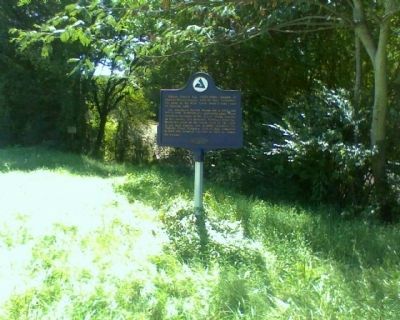
Location. 34° 2.079′ N, 86° 6.674′ W. Marker is in Attalla, Alabama, in Etowah County. Marker is at the intersection of Florida Short Route and Simmons Lane on Florida Short Route. Touch for map. Marker is in this post office area: Attalla AL 35954, United States of America. Touch for directions.
Other nearby markers. At least 8 other markers are within 4 miles of this marker, measured as the crow flies. Electricity for the City of Attalla (approx. 1˝ miles away); First United Methodist Church Of Attalla (approx. 1˝ miles away); “The Junction” (approx. 1.8 miles away); Camp Wills (approx. 1.8 miles away); Camp Sibert (approx. 2.4 miles away); Dwight Mill Village (approx. 3.8 miles away); Alabama City, Alabama (approx. 3.8 miles away); Alabama City World War II Veterans Monument (approx. 3.8 miles away). Touch for a list and map of all markers in Attalla.
Credits. This page was last revised on June 16, 2016. It was originally submitted on November 4, 2009, by Stanley and Terrie Howard of Greer, South Carolina. This page has been viewed 2,840 times since then and 35 times this year. Last updated on May 26, 2014. Photos: 1. submitted on February 17, 2010, by Lee Hattabaugh of Capshaw, Alabama. 2. submitted on November 4, 2009, by Stanley and Terrie Howard of Greer, South Carolina. 3, 4. submitted on November 25, 2011, by Laura Elliott of Rainbow City, Alabama. • Bill Pfingsten was the editor who published this page.


