Deception Pass State Park in Island County, Washington — The American West (Northwest)
Deception Pass
A Park Divided
— Welcome to Deception Pass State Park —
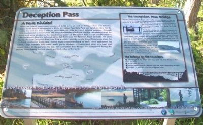
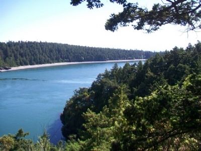
When the federal government transferred 1,700 acres of land on Fidalgo Island and Whidbey Island to the State of Washington in 1925, Deception Pass State Park was barely an idea. For decades, the land had been a military reservation set aside for costal [sic] defense purposes, although little development ever occurred. The bridge had not been built yet, and the two main areas of the future park were divided by the treacherous waters of Deception Pass. Locals used Cranberry Lake and Rosario Beach as informal parks, but there were few facilities, trails or roads. The spark that finally made Deception Pass State Park a reality came during the Great Depression when the Civilian Conservation Corps was created to put young men back to work. Here, and across the nation, Corps members built trails, roads, picnic shelters, restrooms and other structures that remain visible in the park to this day. The Deception Pass Bridge was completed during this period, finally linking the two islands and both sides of this park.
The Deception Pass Bridge
Whidbey Island residents began lobbying the state government to fund the construction of a bridge to Fidalgo Island, which already had a bridge to the mainland in the 1890s. After decades of broken promises and two vetoes, a bill was finally passed and construction of the bridge began in August 1934 during the Great Depression.
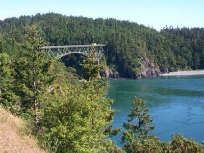
The Wallace Bridge and Structural Company was hired to build the two-span bridge at a cost of $420,000. Much of the physical labor was done by local out-of-work farmers. Young Civilian Conservation Corps enrollees also assisted with the approach routes, using dynamite to blast through the rock on both sides. Construction took just under 12 months. The bridge was completed on July 25th and dedicated on July 31st, 1935. Construction would have been finished a day earlier, but when it came time to lower the final section, it didn't fit. An engineer quickly realized that the hot summer weather had caused the steel to expand. At 4 a.m. the steel had cooled and the last piece was lowered into place.
The Bridge by the Numbers
• Total length: 1,487 feet (Canoe Pass span: 511 feet, Deception Pass span: 976 feet)
• Road width: 22 feet
• Height: approximately 180 feet from the water (depending on tides)
• Roughly 15,000 cars cross the bridge each day
Erected by Deception Pass Park Foundation, Deception Pass State Park, and the Washington State Parks and Recreation Commission.
Topics and series. This historical marker is listed in these topic lists: Bridges & Viaducts • Entertainment
• Environment • Waterways & Vessels. In addition, it is included in the Civilian Conservation Corps (CCC) series list. A significant historical year for this entry is 1925.
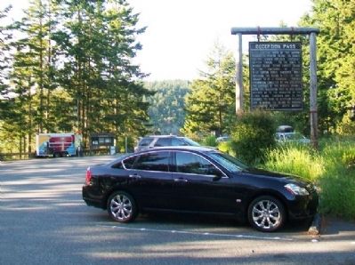
Location. 48° 24.295′ N, 122° 38.683′ W. Marker is in Deception Pass State Park, Washington, in Island County. Marker is on State Highway 20, on the left when traveling north. Marker is adjacent to the west stairway at the parking area just south of the Whidbey Island approach to the Deception Pass Bridge. Touch for map. Marker is in this post office area: Oak Harbor WA 98277, United States of America. Touch for directions.
Other nearby markers. At least 8 other markers are within 7 miles of this marker, measured as the crow flies. A different marker also named Deception Pass (within shouting distance of this marker); a different marker also named Deception Pass (approx. 0.2 miles away); a different marker also named Deception Pass (approx. 0.2 miles away); Crossing the Pass (approx. 0.2 miles away); a different marker also named Deception Pass (approx. 0.4 miles away); U.S. Navy Patrol and Reconnaissance Memorial (approx. 4˝ miles away); Douglas Fir (approx. 5.9 miles away); Town of La Conner 1873-1914 (approx. 6.8 miles away). Touch for a list and map of all markers in Deception Pass State Park.
Credits. This page was last revised on October 14, 2020. It was originally submitted on May 29, 2014, by William Fischer, Jr. of Scranton, Pennsylvania. This page has been viewed 569 times since then and 13 times this year. Photos: 1, 2, 3, 4. submitted on May 29, 2014, by William Fischer, Jr. of Scranton, Pennsylvania.


