Oakton in Fairfax County, Virginia — The American South (Mid-Atlantic)
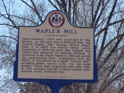
Waple’s Mill
Erected 2000 by Fairfax County History Commission.
Topics and series. This historical marker is listed in this topic list: Agriculture. In addition, it is included in the Virginia, Fairfax County History Commission series list. A significant historical year for this entry is 1867.
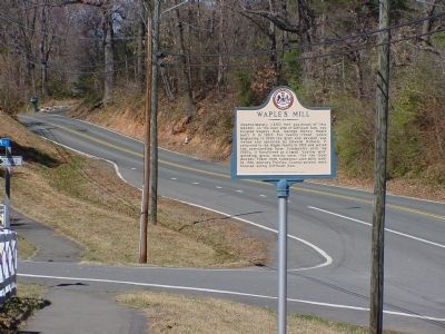
Location. 38° 52.562′ N, 77° 20.39′ W. Marker is in Oakton, Virginia, in Fairfax County. Marker is at the intersection of Waples Mill Road (County Route 664) and Waples Glen Court (Route 7962), on the left when traveling west on Waples Mill Road. Marker is just west of the intersection with Fox Mill Road (County Route 665). Touch for map. Marker is in this post office area: Oakton VA 22124, United States of America. Touch for directions.
Other nearby markers. At least 8 other markers are within 2 miles of this marker, measured as the crow flies. Vale School / Vale Community House (approx. 1.1 miles away); Florence Jodzies (approx. 1.6 miles away); World War II POW Camp Site (approx. 1.6 miles away); Battle of Chantilly (approx. 1.6 miles away); General Reno's Probe East of Ox Road (approx. 1.8 miles away); Pender (approx. 1.8 miles away); Kearny's Stump and the Monument Lot (approx. 1.8 miles away); Kearny and Stevens Monuments (approx. 1.8 miles away). Touch for a list and map of all markers in Oakton.
Credits. This page was last revised on June 16, 2016. It was originally submitted on March 18, 2006, by J. J. Prats of Powell, Ohio. This page has been viewed 3,831 times since then and 53 times this year. Last updated on April 28, 2008, by Patricia Strat of Oakton, Virginia. Photos: 1, 2. submitted on March 18, 2006, by J. J. Prats of Powell, Ohio. • Kevin W. was the editor who published this page.

