Rye in Rockingham County, New Hampshire — The American Northeast (New England)
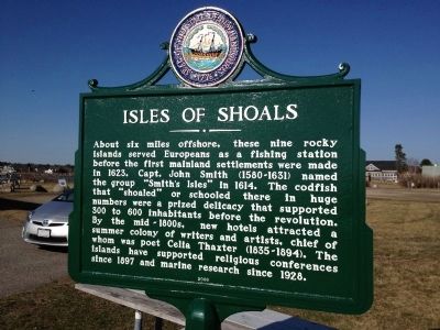
Isles Of Shoals
Erected 2006 by New Hampshire Division of Historical Resources. (Marker Number 018.)
Topics and series. This historical marker is listed in these topic lists: Colonial Era • Exploration • Settlements & Settlers • Waterways & Vessels. In addition, it is included in the New Hampshire Historical Highway Markers series list. A significant historical year for this entry is 1623.
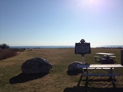
Location. 43° 0.092′ N, 70° 44.647′ W. Marker is in Rye, New Hampshire, in Rockingham County. Marker can be reached from Ocean Boulevard (Route 1A). Rye Harbor State Park. Touch for map. Marker is in this post office area: Rye NH 03870, United States of America. Touch for directions.
Other nearby markers. At least 8 other markers are within 5 miles of this marker, measured as the crow flies. New Isles of Shoals Marker (within shouting distance of this marker); Atlantic Cable Station and Sunken Forest (approx. one mile away); Rye NH War Memorial (approx. 1.6 miles away); Key Facts about Pulpit Rock Tower (approx. 2˝ miles away); Pulpit Rock Fire Control Tower (approx. 2˝ miles away); Portsmouth NH World War II Marker (approx. 4.9 miles away); William and Mary Raids (approx. 5 miles away); New Castle Congregational Church (approx. 5 miles away). Touch for a list and map of all markers in Rye.
More about this marker. At the back of the parking lot.
Credits. This page was last revised on January 29, 2021. It was originally submitted on March 22, 2012, by Rod Funston of Eastham, Massachusetts. This page has been viewed 874 times since then and 19 times this year. Last updated on January 23, 2021, by Bradley Owen of Morgantown, West Virginia. Photos: 1, 2. submitted on March 22, 2012, by Rod Funston of Eastham, Massachusetts. 3. submitted on January 21, 2021, by Allen C. Browne of Silver Spring, Maryland. • Bill Pfingsten was the editor who published this page.


