Near Winchester in Clark County, Kentucky — The American South (East South Central)
An Unrealized Plan
The Front Moves South
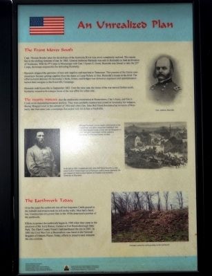
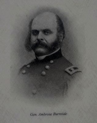
Capt. Thomas Brooks' plan for the defense of the Kentucky River was never completely realized. The reason lies in the shifting fortunes of war. In 1863, General Ambrose Burnside was sent to Kentucky to lead an invasion of Tennessee. With his 9th Corps in Mississippi with Gen. Ulysses S. Grant, Burnside was forced to take the 23rd Corps, the troops responsible for defending Kentucky.
Burnside stripped the garrisons of men and supplies and marched to Tennessee. The concern of the Union command now became getting supplies from the depot at Camp Nelson to Gen. Burnside's troops in the field. The effort to build defenses for Kentucky's fords, ferries, and bridges was slowed as engineers and quartermasters turned their energies to the Knoxville Campaign.
Burnside took Knoxville in September 1863. Over the next year, the focus of the war moved further south. Kentucky ceased to be a major focus of the war effort for either side.
The records indicate that the earthworks constructed at Boonesboro, Clay's Ferry, and Tate's Creek never mounted permanent artillery. They were probably manned and armed as necessary, for instance, during Morgan's raid in the summer of 1864 and when Gen. John Bell Hood threatened an invasion of Kentucky late that same year, a campaign that ended with his defeat at Nashville.
The Earthwork Today
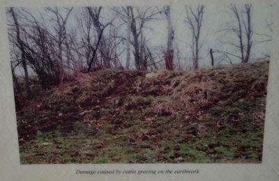
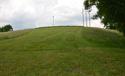
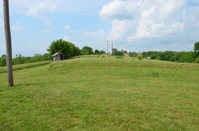
Over the years the earthwork was all but forgotten. Cattle grazed in the redoubt and erosion took its toll on the walls. Man had a hand, too. Construction of a power line in the 1950s destroyed a portion of the earthwork.
Efforts to protect the earthwork began in 1998 when they came to the attention of Mr. Jerry Raisor, Curator at Fort Boonesborough State Park. The Clark County Fiscal Court purchased the site in 2001. In 2003 the Civil War Fort at Boonesboro was listed in the National Register of Historic Places. Today, efforts to preserve and interpret the site continue.
Erected by The Winchester/Clark County Tourism Commission.
Topics. This historical marker is listed in these topic lists: Forts and Castles • War, US Civil. A significant historical month for this entry is September 1863.
Location. 37° 53.385′ N, 84° 15.553′ W. Marker is near Winchester, Kentucky, in Clark County. Marker can be reached from Ford Road/4 Mile Road (Kentucky Route 1924) 1.2 miles south of Boonesboro Road (Kentucky Route 627), on the left when traveling south. The exhibit can be reached from the parking area on KY Route 1924. The trailhead is at the edge of the parking area here. It is a ½ mile hike up the trail to the top of the hill where the fort is. Touch for map. Marker is at or near this postal address: 1250 Ford Road, Winchester KY 40391, United States of America. Touch for directions.
Other nearby markers. At least 8 other markers are within walking distance of this marker. Thomas B. Brooks, Army Engineer (here, next to this marker); A Defensive Strategy (here, next to this marker); Common Cliffside Plants (within shouting distance of this marker); Rock and Man (within shouting distance of this marker); Building the Earthwork (within shouting distance of this marker); The Eye of the Rich Land (within shouting distance of this marker); The Quest for Land (about 300 feet away, measured in a direct line); Inside the Earthwork (about 300 feet away). Touch for a list and map of all markers in Winchester.
More about this marker. This marker is part of the historic site known as the "Civil War Fort at Boonesboro." CAUTION: The climb up the hill is VERY steep. It involves a change in elevation of 230 feet. Not recommended for people that are not in good physical shape or condition.
Also see . . . Civil War Fort at Boonesboro. (Submitted on June 22, 2014.)
Photographed By Karl Stelly, June 1, 2014
3. An Unrealized Plan Wayside Exhibit
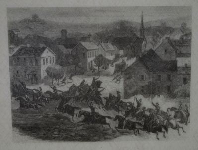
Although Kentucky was no longer a focal point of the Confederate war effort, incursions continued. Gen. John Hunt Morgan made a foray into the Bluegrass in 1864. Morgan's raid ended with his defeat at Cynthiana, in Harrison County, in June.
Photographed By Karl Stelly, June 1, 2014
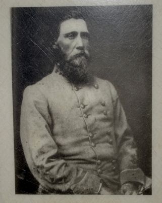
4. General John Bell Hood, C.S.A.
In the fall of 1864, Confederate General John Bell Hood mounted a campaign to drive Union troops out of Tennessee and to invade Kentucky. He was stopped by back-to-back defeats at Franklin and Nashville, Tennessee in December.
Credits. This page was last revised on September 17, 2020. It was originally submitted on June 21, 2014, by Karl Stelly of Gettysburg, Pennsylvania. This page has been viewed 553 times since then and 22 times this year. Photos: 1, 2, 3, 4, 5, 6, 7, 8, 9. submitted on June 21, 2014, by Karl Stelly of Gettysburg, Pennsylvania. • Bernard Fisher was the editor who published this page.
