Near Chapel Hill in Marshall County, Tennessee — The American South (East South Central)
Forrest Boyhood Home
1830-1833
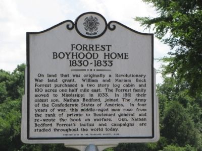
On land that was originally a Revolutionary War land grant, William and Mariam Beck Forrest purchased a two story log cabin and 180 acres one half mile east. The Forrest family moved to Mississippi in 1833. In 1861 their oldest son, Nathan Bedford, joined The Army of the Confederate States of America. In four years of war, this middle-aged man rose from the rank of private to lieutenant general and re-wrote the book on warfare. Gen. Nathan Bedford Forrest's tactics and campaigns are studied throughout the world today.
Erected 2005 by The Tennessee Society, MOSB.
Topics. This historical marker is listed in these topic lists: Man-Made Features • War, US Civil. A significant historical year for this entry is 1833.
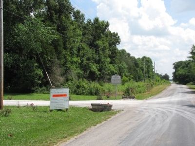
Location. 35° 38.292′ N, 86° 45.459′ W. Marker is near Chapel Hill, Tennessee, in Marshall County. Marker is on Pyles Road, 2.3 miles north of Sylvester Chunn Highway (Tennessee Route 99), on the right when traveling north. Touch for map. Marker is at or near this postal address: 4435 Pyles Road, Chapel Hill TN 37034, United States of America. Touch for directions.
Other nearby markers. At least 8 other markers are within 6 miles of this marker, measured as the crow flies. A different marker also named Forrest Boyhood Home (within shouting distance of this marker); Freeman's Battery (about 500 feet away, measured in a direct line); Swaim House (approx. 3.7 miles away); Isaac Rainey (approx. 4.6 miles away); Henry Hollis Horton (approx. 5 miles away); Edwards Grove Church (approx. 5.3 miles away); Moses Steele Cemetery (approx. 5.4 miles away); Old Reed’s Store (approx. 5.4 miles away). Touch for a list and map of all markers in Chapel Hill.
Credits. This page was last revised on June 16, 2016. It was originally submitted on June 21, 2014, by Lee Hattabaugh of Capshaw, Alabama. This page has been viewed 957 times since then and 34 times this year. Photos: 1, 2, 3. submitted on June 21, 2014, by Lee Hattabaugh of Capshaw, Alabama. • Bernard Fisher was the editor who published this page.


