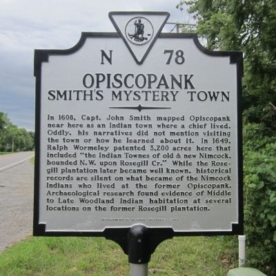
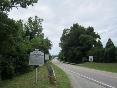
Near Urbanna in Middlesex County, Virginia — The American South (Mid-Atlantic)
Opiscopank
Smith's Mystery Town
Erected 2010 by Department of Historic Resources. (Marker Number N-78.)
Topics and series. This historical marker is listed in these topic lists: Colonial Era • Exploration • Native Americans • Settlements & Settlers. In addition, it is included in the Virginia Department of Historic Resources (DHR) series list. A significant historical year for this entry is 1608.
Location. 37° 37.764′ N, 76° 34.292′ W. Marker is near Urbanna, Virginia, in Middlesex County. Marker is on Urbanna Road (Virginia Route 227) 0.1 miles east of Mollys Way, on the left when traveling west. Touch for map. Marker is at or near this postal address: 82 Mariners Way, Saluda VA 23149, United States of America. Touch for directions.
Other nearby markers. At least 8 other markers are within walking distance of this marker. Urbanna Creek (within shouting distance of this marker); Rosegill (approx. 0.2 miles away); Bridge Over the Creek (approx. ¼ mile away); Steamboat Era (approx. 0.3 miles away); Overlook (approx. 0.3 miles away); Watling Street and Urbanna's Master Builder (approx. 0.4 miles away); Cross Street (approx. 0.4 miles away); The Backyard Garden Was Essential (approx. half a mile away). Touch for a list and map of all markers in Urbanna.
Credits. This page was last revised on November 23, 2021. It was originally submitted on June 22, 2014, by Bernard Fisher of Richmond, Virginia. This page has been viewed 754 times since then and 49 times this year. Photos: 1, 2. submitted on June 22, 2014, by Bernard Fisher of Richmond, Virginia.

