Isle La Motte in Grand Isle County, Vermont — The American Northeast (New England)
Site of French Fort Ste. Anne
Vermont's oldest settlement
On this shore was the site of Fort Ste. Anne built in 1666 by Capt. Pierre La Motte for defense against the Mohawks. The Jesuits celebrated the first Mass and erected the first Chapel. Though not permanent, this was Vermont's first white settlement.
Erected 1949 by Vermont Historic Sites Commission.
Topics. This historical marker is listed in these topic lists: Churches & Religion • Colonial Era • Forts and Castles • Settlements & Settlers. A significant historical year for this entry is 1666.
Location. 44° 54.021′ N, 73° 20.89′ W. Marker is in Isle La Motte, Vermont, in Grand Isle County. Marker is on Shrine Road, 0.1 miles north of St. Anne's Road. Near Saint Anne's shrine at 92 St. Anne's Road. Touch for map. Marker is in this post office area: Isle La Motte VT 05463, United States of America. Touch for directions.
Other nearby markers. At least 8 other markers are within 4 miles of this marker, measured as the crow flies. A Place Of Pilgrimage (a few steps from this marker); Samuel de Champlain Monument (within shouting distance of this marker); Sweet's Ferry (approx. 1.2 miles away); Sept. 11, 1814 (approx. 1.7 miles away in New York); Matthew Sax (approx. 1.7 miles away in New York); 1805 Log Home (approx. 2.9 miles away in New York); Point au Fer Historic Site (approx. 3 miles away in New York); The "White House" (approx. 3.1 miles away in New York). Touch for a list and map of all markers in Isle La Motte.
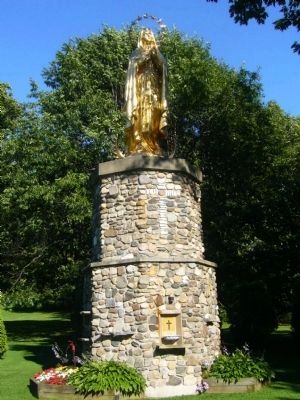
More about this marker. The marker is located on the shores of Lake Champlain. Other points of interest include St. Anne's Shrine and a Statue commemorating Samuel de Champlain.
Additional keywords. Lake Champlain
Credits. This page was last revised on November 4, 2020. It was originally submitted on September 30, 2009, by Karen Eaton of Westfield, Massachusetts. This page has been viewed 2,018 times since then and 46 times this year. Last updated on June 23, 2014, by Kevin Craft of Bedford, Quebec. Photos: 1, 2, 3, 4. submitted on September 30, 2009, by Karen Eaton of Westfield, Massachusetts. • Bill Pfingsten was the editor who published this page.


