Covington in Tipton County, Tennessee — The American South (East South Central)
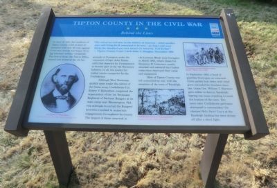
Tipton County in the Civil War
Behind the Lines
"The end of an evil year in the history of America—what another year will bring forth remained to be seen—perhaps and most likely the bloodiest war ever known in America, God forbid!" — Tipton County Court Clerk John T. Douglas, December 1861
On June 10, 1861, 943 residents of Tipton County voted in favor of secession with only 16 votes against. Local men already had begun forming volunteer military companies. The first of these, the Tipton Rifles, trained and drilled at the old fairgrounds in Covington under the command of Capt. John Turner until they departed for Germantown to become part of the 4th Tennessee Infantry. In all, the county furnished twelve companies for the Confederacy.
Although West Tennessee quickly came under the control of the Union army, Confederate Col. Robert V. Richardson completed the organization of the 1st Tennessee Regiment of Partisan Rangers at its main camp near Bloomington. Federal attempts to curtail the Rangers’ activities resulted in numerous engagements throughout the county. The largest of these occurred in the Lemmon Woods near Covington in March 1863, where Union Col. Benjamin H. Grierson’s cavalry attacked and scattered the Confederates then destroyed their camp and equipment.
Most of Tipton County was left untouched by war, with the exception of the town of Randolph. In September 1862, a band of guerillas fired upon an unarmed Union packet boat laden with relief goods intended for Southern families. Union Gen. William T. Sherman gave orders to destroy Randolph, leaving one house standing to mark the location of the town. Two years later, Confederate partisans attempted to commandeer the steamer Belle Saint Louis at the Randolph landing but were driven off after a short fight.
(captions)
(lower left) Col. Robert V. Richardson Courtesy Tennessee Civil War National Heritage Area
(lower center) Confederates firing on Union gunboats Courtesy U.S. Naval Historical Center
(upper right) Confederate recruits drilling in camp, Harper’s Weekly, Nov 9, 1861
Erected by Tennessee Civil War Trails.
Topics and series. This historical marker is listed in this topic list: War, US Civil. In addition, it is included in the Tennessee Civil War Trails series list. A significant historical month for this entry is March 1863.
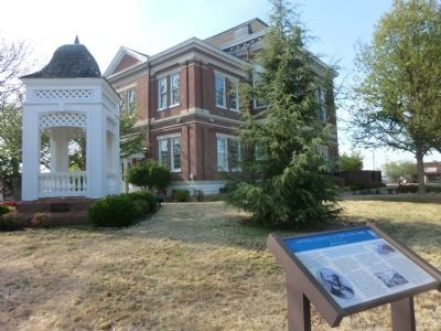
Location. 35° 33.834′ N, 89° 38.766′ W. Marker is in Covington, Tennessee, in Tipton County. Marker is at the intersection of East Pleasant Avenue (Tennessee Route 54) and East Court Square, on the left when traveling east on East Pleasant Avenue. The marker is located on
the grounds of the Tipton County Courthouse. Touch for map. Marker is in this post office area: Covington TN 38019, United States of America. Touch for directions.
Other nearby markers. At least 8 other markers are within walking distance of this marker. Tipton County Confederate Monument (a few steps from this marker); Isaac Hayes (about 300 feet away, measured in a direct line); Hotel Lindo (about 400 feet away); Frances Boyd Calhoun (about 500 feet away); St. Matthew's Episcopal Church (about 700 feet away); Thomas Goode (about 700 feet away); Canaan Missionary Baptist Church History (about 800 feet away); Cadmus Marcellus Wilcox (approx. ¼ mile away). Touch for a list and map of all markers in Covington.
Credits. This page was last revised on June 16, 2016. It was originally submitted on June 23, 2014, by Don Morfe of Baltimore, Maryland. This page has been viewed 1,116 times since then and 44 times this year. Photos: 1, 2. submitted on June 23, 2014, by Don Morfe of Baltimore, Maryland. • Bernard Fisher was the editor who published this page.

