Randolph in Tipton County, Tennessee — The American South (East South Central)
Twin Defenses
Forts Randolph and Wright
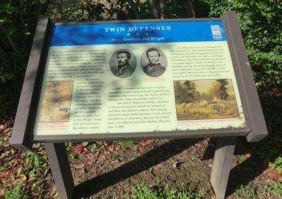
For several months, enlistees from across the state came to the forts to learn to become soldiers. Aided by slaves from the region, they built extensive earthworks and other structures; one brick powder magazine still exists at Fort Wright. Young men who had joined the infantry, cavalry, or artillery companies in their native counties, assembled in these camps and were organized into regiments. One such private was Nathan Bedford Forrest, who began his military career here.
Col. John P. McCown and Maj. Alexander P. Stewart molded and drilled the enlistees at both forts into effective soldiers. The training produced enough skilled gunners to man not only the batteries at these forts, but also the Confederate river defenses near New Madrid, Missouri, later in 1861.
By 1862, most of the men and guns had been reassigned to other defensive positions. The Confederates abandoned the posts entirely that summer. On September 25, 1862, a small band of Confederate guerrillas fired into the unarmed river packet Eugene, which was docked at Randolph landing. No serious damage occurred, but in retaliation, Union Gen. William T. Sherman ordered the entire town of Randolph burned except for an old church and one dwelling.
(captions)
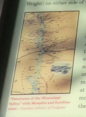
(lower left) "Panorama of the Mississippi Valley," with Memphis and fortifications - Courtesy Library of Congress
(upper center) Gen. Alexander P. Stewart and Gen. William T. Sherman Courtesy Library of Congress
(lower right) This idealized view of a “Confederate camp” was published in London in 1874 Courtesy Library of Congress
Erected by Tennessee Civil War Trails.
Topics and series. This historical marker is listed in these topic lists: Forts and Castles • War, US Civil. In addition, it is included in the Tennessee Civil War Trails series list. A significant historical month for this entry is April 1861.
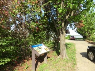
Location. 35° 31.063′ N, 89° 53.407′ W. Marker is in Randolph, Tennessee, in Tipton County. Marker is on Ballard Slough Road, 0.1 miles north of Randolph Road, on the left when traveling north. Touch for map. Marker is in this post office area: Drummonds TN 38023, United States of America. Touch for directions.
Other nearby markers. At least 8 other markers are within 9 miles of this marker, measured as the crow flies. Randolph (a few steps from this marker); Randolph United Methodist Church (within shouting distance of this marker); Fort Wright, C.S.A. (approx. ¼ mile away); Munford United Methodist Church (approx. 6.4 miles away); Mt. Zion — Munford (approx. 6½ miles away); a different marker also named Randolph (approx. 7.6 miles away); Outer Breastworks (approx. 8½ miles away); Atoka Evangelical Presbyterian Church (approx. 8½ miles away). Touch for a list and map of all markers in Randolph.
Credits. This page was last revised on June 16, 2016. It was originally submitted on June 23, 2014, by Don Morfe of Baltimore, Maryland. This page has been viewed 803 times since then and 11 times this year. Photos: 1, 2, 3. submitted on June 23, 2014, by Don Morfe of Baltimore, Maryland. • Bernard Fisher was the editor who published this page.


