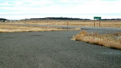
Near Bryce in Garfield County, Utah — The American Mountains (Southwest)
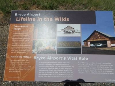
Bryce Airport
Bryce Airport's Vital Role
In this remote region, with major hospitals and airfields hundreds of miles away, Bryce Airport provides critical emergency support. Built in 1936 as an emergency landing strip for commercial airlines, the airport has served that purpose twice since then. In 2005, American Airlines Flight 28, with more than 50 passengers on board, lost all engine power and safely landed here. Bryce Airport is also the main staging area for local search-and-rescue operations and fire management.
At 7,400 feet long, Bryce Airport's runway is unusually long for a small airport. That's both because it is designed to receive commercial aircraft and because of the high elevation of the runway (7,586 feet). Air is thinner at higher altitudes, providing less lift for airplanes. Heat further thins the air, forcing some small planes to avoid mid-day take-offs here during the summer.
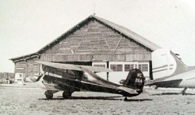
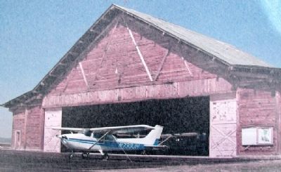
Bryce Airport Hangar
Built in 1936, the airport's hangar was funded by the Works Progress Administration (WPA), which provided jobs for unemployed Americans during the Great Depression. WPA funding required matching work contributions from local communities, so local county commissioners designed the hangar and supervised construction. Built of native ponderosa pine, the hangar is listed on the National Register of Historic Places. Each year, thousands of tourists arrive by air at this historic airport to see Bryce Canyon National Park.
Fire on the Plateau
Fires are a natural part of life here on the Paunsaugunt Plateau. When fires start in the region - whether by lightning, accident, or prescribed burn - the airport serves as a staging area for fire monitoring and management, as it did in 2002 during the 78,000-acre Sanford fire in Dixie National Forest.
Erected by Scenic Byway 12.
Topics and series. This historical marker is listed in these topic lists: Air & Space • Man-Made Features. In addition, it is included in the Works Progress Administration (WPA) projects series list. A significant historical year for this entry is 1936.
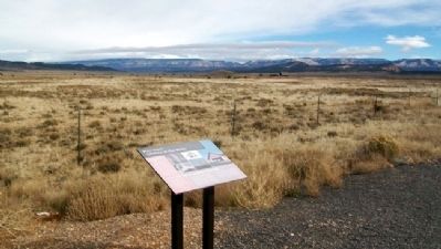
Location. 37° 41.756′ N, 112° 10.199′ W. Marker is near Bryce, Utah, in Garfield County. Marker is on Utah Route 12, 0 miles west of the road to Bryce Canyon Airport, on the right when traveling west. Marker is in a highway pullout west of the airport entrance. Touch for map. Marker is in this post office area: Bryce UT 84764, United States of America. Touch for directions.
Other nearby markers. At least 8 other markers are within 8 miles of this marker, measured as the crow flies. Stephen Tyng Mather (approx. 3.9 miles away); Post-War Service Station (approx. 4.6 miles away); Wheeling through the Years (approx. 4.6 miles away); Bryce Canyon Lodge (approx. 4.8 miles away); Streetscape (approx. 4.8 miles away); Bryce Amphitheater (approx. 5.1 miles away); Tropic Pioneers (approx. 6.8 miles away); Butch Cassidy (approx. 7˝ miles away).
Credits. This page was last revised on June 16, 2016. It was originally submitted on February 26, 2011, by William Fischer, Jr. of Scranton, Pennsylvania. This page has been viewed 793 times since then and 21 times this year. Last updated on June 24, 2014, by Bill Kirchner of Tucson, Arizona. Photos: 1. submitted on February 26, 2011, by William Fischer, Jr. of Scranton, Pennsylvania. 2. submitted on June 24, 2014, by Bill Kirchner of Tucson, Arizona. 3, 4, 5, 6. submitted on February 26, 2011, by William Fischer, Jr. of Scranton, Pennsylvania. • Syd Whittle was the editor who published this page.

