Springfield in Windsor County, Vermont — The American Northeast (New England)
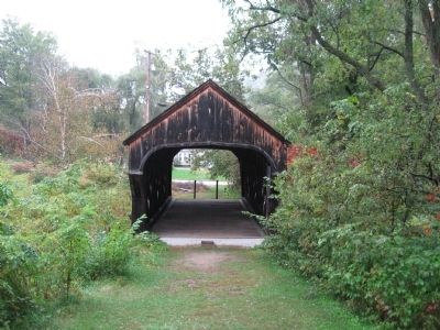
Eureka Schoolhouse & Baltimore Covered Bridge
Inscription.
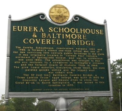
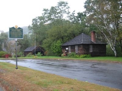
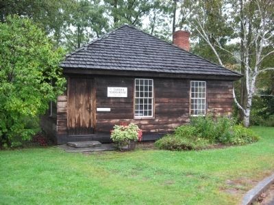
The Eureka Schoolhouse, constructed between 1785 and 1790, is Vermontís oldest one-room school and one of the few surviving 18th century public buildings in the state. It was originally located in the “Eureka Four Corners,” northeast of Springfield village, and was in continuous use until 1900. The schoolhouse was brought to this site and restored by a committee of Springfield citizens and the Vermont Board of Historic Sites in 1968. The pine board exterior, simulating stone block, was once painted golden yellow and the hipped roof was cobalt blue.
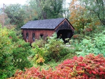
The 37 foot long Baltimore Covered Bridge, a “Town Lattice Truss” type ridge was built in 1870 by Granville Leland and Dennis Allen to cross the Great Brook in North Springfield. It was moved to this location in 1970.
Vermont Division for Historic Preservation – 2001
Erected 2001 by Vermont Division for Historic Preservation.
Topics and series. This historical marker is listed in these topic lists: Bridges & Viaducts • Colonial Era • Education. In addition, it is included in the Covered Bridges series list. A significant historical year for this entry is 1785.
Location. 43° 16.163′ N, 72° 26.808′ W. Marker is in Springfield, Vermont, in Windsor County. Marker is on Vermont Route 11 just east of Perley Gordon Road, on the left when traveling east. Touch for map. Marker is in this post office area: Springfield VT 05156, United States of America. Touch for directions.
Other nearby markers. At least 8 other markers are within 3 miles of this marker, measured as the crow flies. Charlestown War Memorial (approx. 2.6 miles away in New Hampshire); Charlestown World War II and Korean Conflict Memorial (approx. 2.6 miles away in New Hampshire); Charlestown Civil War and World War Memorial (approx. 2.6 miles away in New Hampshire); Helen Hartness Flanders (approx. 2.7 miles away); James Hartness & Precision Valley Inventors (approx. 2.7 miles away); General John Stark's Expedition to Bennington (approx. 2.7 miles away in New Hampshire); This Boulder from the Hill-Side (approx. 2.7 miles away in New Hampshire); Captain Phineas Stevens (approx. 2.8 miles away in New Hampshire). Touch for a list and map of all markers in Springfield.
Regarding Eureka Schoolhouse & Baltimore Covered Bridge. The schoolhouse is now a tourist information center.
Photographed By Michael Herrick, October 3, 2009
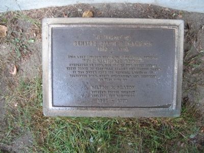
6. Small Plaque in Front of the Bridge
Senator Ralph E. Flanders
1880 – 1970
This last covered bridge in Springfield, Vermont “The Baltimore Bridge”
completed in 1870, was one of two built across Great Brook by Granville Leland and Dennis Allen.
It was moved from its original location on Baltimore Road, North Springfield and restored
On this site by
Milton S. Graton
Covered Bridge Builder
Ashland, New Hampshire
1969 – 1970
Credits. This page was last revised on June 16, 2016. It was originally submitted on October 11, 2009, by Michael Herrick of Southbury, Connecticut. This page has been viewed 1,289 times since then and 18 times this year. Last updated on July 1, 2014, by Kevin Craft of Bedford, Quebec. Photos: 1, 2, 3, 4, 5, 6. submitted on October 11, 2009, by Michael Herrick of Southbury, Connecticut. • Bill Pfingsten was the editor who published this page.
