Midtown - Downtown in Columbia in Richland County, South Carolina — The American South (South Atlantic)
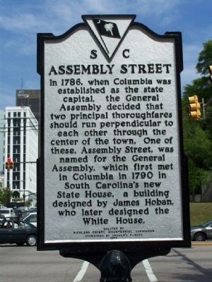
Assembly Street
Erected 1977 by Richland County Bicentennial Commission Sponsored by Cromer's P-Nuts. (Marker Number 40-90.)
Topics. This historical marker is listed in this topic list: Roads & Vehicles. A significant historical year for this entry is 1786.
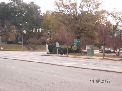
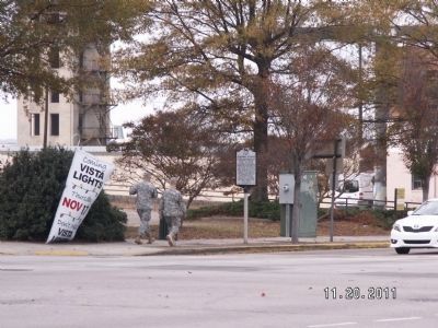
Location. 34° 0.038′ N, 81° 2.131′ W. Marker is in Columbia, South Carolina, in Richland County. It is in Midtown - Downtown. Marker is at the intersection of Gervais Street (U.S. 1 - 378) and Assembly Street (U.S. 76), on the right when traveling east on Gervais Street. Touch for map. Marker is in this post office area: Columbia SC 29201, United States of America. Touch for directions.
Other nearby markers. At least 8 other markers are within walking distance of this marker. J. Marion Sims (within shouting distance of this marker); Robert E. Lee Memorial Highway (about 400 feet away, measured in a direct line); South Carolina Veterans Memorial (about 500 feet away); Cap. Swanson Lunsford (about 500 feet away); Here Stood The State House (about 500 feet away); 1001 Gervais Street (about 500 feet away); Spanish-American War Cannon (about 500 feet away); The Architecture of Strength (about 500 feet away). Touch for a list and map of all markers in Columbia.
Also see . . .
1. James Hoban, From: The Columbia Encyclopedia, Sixth Edition - Date: 2008. James Hoban , c.1762-1831, American architect, b. Ireland. By 1789, Hoban had immigrated to the United States. He designed the South Carolina statehouse, which was burned in 1865. In 1792 he moved to Washington, D.C., and won the competition for the design of a mansion for the President (later called the White House), which he built from 1792 to 1799 and rebuilt after it was burned by the British in 1814. He was one of the supervising architects who served at the Capitol in the execution of Dr. William Thornton's design, and he worked on public buildings for more than 25 years. (Submitted on May 1, 2008, by Mike Stroud of Bluffton, South Carolina.)
2. Wikipedia entry for James Hoban. The Hoban Portfolio. (Submitted on May 1, 2008, by Mike Stroud of Bluffton, South Carolina.)
Credits. This page was last revised on February 16, 2023. It was originally submitted on May 1, 2008, by Mike Stroud of Bluffton, South Carolina. This page has been viewed 1,326 times since then and 45 times this year. Photos: 1. submitted on May 1, 2008, by Mike Stroud of Bluffton, South Carolina. 2, 3. submitted on November 22, 2011, by Anna Inbody of Columbia, South Carolina. • Kevin W. was the editor who published this page.


