Eau Claire in Eau Claire County, Wisconsin — The American Midwest (Great Lakes)
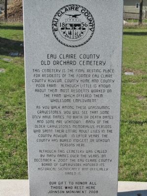
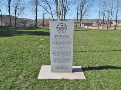
Eau Claire County Old Orchard Cemetery
— Eau Claire County • 1856 —
This cemetery is the final resting place for residents of the former Eau Claire County Asylum, County Home and County Poor Farm. Although little is known about them, most residents worked on the farm, which offered them "wholesome employment."
As you walk among these unassuming gravestones, you will see that some only have names, no birth or death dates, and some are unknown. Many of the older gravestones memorialize persons who spent their entire adult lives in the County Asylum. In later years, the County has buried indigent or unknown persons here.
Although this cemetery was called by many names over the years, on December 4, 2007, the Eau Claire County Board of Supervisors honored its historical significance and officially named it.
Those Who Rest Here
Johnson Monument 2008
Erected 2008 by Johnson Monument Company, Chippewa Falls, Wisconsin.
Topics. This historical marker is listed in this topic list: Cemeteries & Burial Sites. A significant historical month for this entry is December 1773.
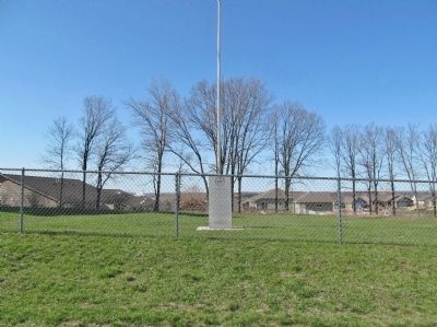
Location. 44° 49.856′ N, 91° 32.114′ W. Marker is in Eau Claire, Wisconsin, in Eau Claire County. Marker is on Mesa Ridge Drive west of West Ridge Drive, on the left when traveling east. Touch for map . Marker is in this post office area: Eau Claire WI 54703, United States of America. Touch for directions.
Other nearby markers. At least 8 other markers are within 2 miles of this marker, measured as the crow flies. Lumber and Politics (approx. 1.2 miles away); Waldemar Ager House (approx. 1˝ miles away); "The Log Flume" (approx. 1˝ miles away); The "Flume" (approx. 1.6 miles away); Legend of Paul Bunyan (approx. 1.7 miles away); Luther Midelfort: A History of Caring (approx. 1.7 miles away); Carson Park Baseball Stadium (approx. 1.8 miles away); Henry Aaron / Eau Claire Baseball (approx. 1.8 miles away). Touch for a list and map of all markers in Eau Claire.
Also see . . .
1. Asylum Cemetery. Find A Grave website entry (Submitted on July 3, 2014.)
2. A Grave Situation. Volume One website entry (Submitted on July 3, 2014.)
Credits. This page was last revised on June 28, 2022. It was originally submitted on July 3, 2014, by Keith L of Wisconsin Rapids, Wisconsin. This page has been viewed 1,220 times since then and 63 times this year. Photos: 1, 2, 3. submitted on July 3, 2014, by Keith L of Wisconsin Rapids, Wisconsin.


