Mount Pleasant in Sanpete County, Utah — The American Mountains (Southwest)
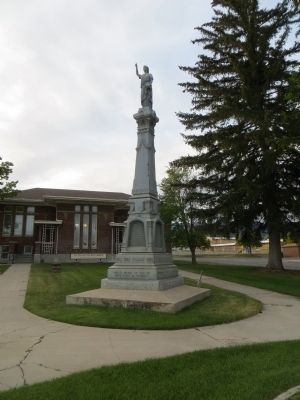
Pioneer Monument
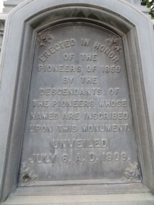
Front Plate:
Erected in Honor of the Pioneers of 1859 by the descedants of the Pioneers, whose names are inscribed upon this Monument. Unveiled July 6, 1909.
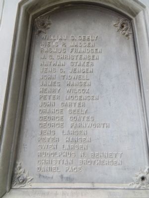
Right Plate:
William S. Seely, Neils P. Madsen, Rasmus Frandsen, M.C. Christensen, Nathan Staker, Jens C. Jensen, John Tidwell, James Hansen, Henry Wilcox, Peter Mogensen, John Carter, Orange Seely, George Coates, George Farnsworth, Jens Larsen, Peter Hansen, Swen Larsen, Rudolphus N. Bennett, Christian Brotherson, Daniel Page
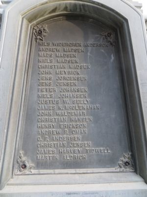
Back Plate:
Neils Widergren Anderson, Andrew Madsen, Mads Madsen, Neils Madsen, Christian Madsen, John Meyrick, Jens Jorgensen, Jens Jensen. Peter Johansen, Neils Johansen, Justus W. Seely, James K. McClenahan, John Waldermar, Christian Hansen, Henry Ericksen, Andrew P. Oman, C.P. Anderson, Christian Jensen, James Harvey Tidwell, Martin Aldrich
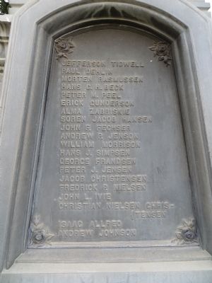
Left Plate:
Jefferson Tidwell, Paul Dehlin, Mortin Rasmussen, Hans C.H. Beck, Peter M. Peel, Erick Gunderson, Alma Zabriskie, Soren Jacob Hansen, John F. Fechser, Andrew P. Jensen, William Morrison, Hans J. Simpsen, George Frandsen, Peter J. Jensen, Jacob Christensen, Frederick P. Neilson, John L. Ivie, Christian Neilson Christensen, Isaac Allred, Andrew Johansen
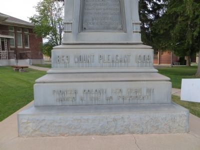
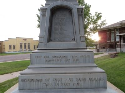
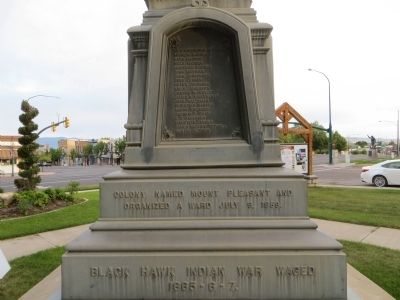
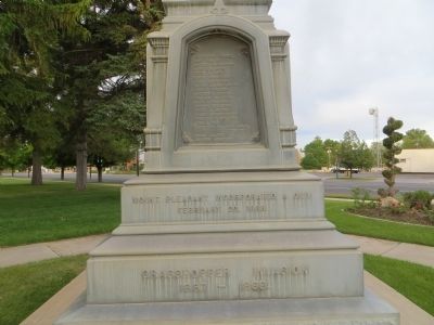
Inscription of Base Plate: Front Plinth:
1859 Mt. Pleasant 1909 Base: Pioneer Colony led here by James R. Ivie as President
Right Plinth: Fort for protection from Indians completed July 1859. Base: Dimensions of Fort, 26 rods square, wall 12 feet high.
Back Plinth: Colony named Mt. Pleasant, and organized a Ward, July 9, 1859. Base: Black Hawk War waged 1865-6-7.
Left Plinth: Mt. Pleasant Incorporated a City February 10, 1868. Base: Grasshopper Invasion, 1867-1868.
Erected 1909 by Descendants of the Pioneers.
Topics. This historical marker and monument is listed in this topic list: Settlements & Settlers. A significant historical month for this entry is February 1854.
Location. 39° 32.79′ N, 111° 27.299′ W. Marker is in Mount Pleasant, Utah, in Sanpete County. Marker is at the intersection of State Street and Main Street, on the right when traveling north on State Street. Marker is on the southeast corner. Touch for map. Marker is in this post office area: Mount Pleasant UT 84647, United States of America. Touch for directions.
Other nearby markers. At least 8 other markers are within 6 miles of this marker, measured as the crow flies. Mt. Pleasant Fort (within shouting distance of this marker); The Liberal Hall (about 500 feet away, measured in a direct line); Last Peace Treaty (about 700 feet away); William Stuart Seeley House (about 700 feet away); Spring City Pioneer Cemetery (approx. 5 miles away); Behunin-Beck House (approx. 5.1 miles away); Spring City (approx. 5.1 miles away); City Hall (approx. 5.2 miles away). Touch for a list and map of all markers in Mount Pleasant.
Credits. This page was last revised on June 16, 2016. It was originally submitted on July 7, 2014, by Bill Kirchner of Tucson, Arizona. This page has been viewed 692 times since then and 45 times this year. Photos: 1, 2, 3, 4, 5, 6, 7, 8, 9. submitted on July 7, 2014, by Bill Kirchner of Tucson, Arizona. • Al Wolf was the editor who published this page.
