Near Fish Creek in Door County, Wisconsin — The American Midwest (Great Lakes)
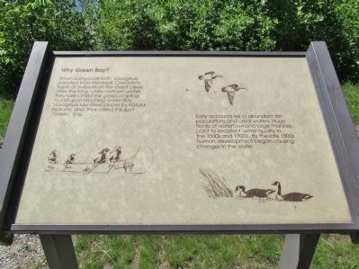
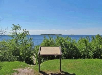
Why Green Bay?
When spring burst forth, voyageurs paddled from Montreal, Canada to trade at outposts on the Great Lakes. After the long, white northern winter, they welcomed the green of spring found upon reaching Green Bay. Voyagers identified places by natural features, and, thus called this spot "Green" Bay.
Early accounts tell of abundant fish populations and clear waters. Huge flocks of waterfowl and large marshes point to excellent water quality in the 1600s and 1700s. By the late 1800s human development began causing changes in the water.
Topics. This historical marker is listed in these topic lists: Exploration • Waterways & Vessels.
Location. 45° 9.196′ N, 87° 14.435′ W. Marker is near Fish Creek, Wisconsin, in Door County. Marker is on Shore Road, 2 miles north of Main Street (Wisconsin Highway 42), on the left when traveling north. Marker is ˝ mile north of Skyline Road in Peninsula State Park. Fee area; a vehicle admission sticker is required. Touch for map. Marker is at or near this postal address: 9462 Shore Road, Fish Creek WI 54212, United States of America. Touch for directions.
Other nearby markers. At least 8 other markers are within 2 miles of this marker, measured as the crow flies. Island Overlook (about 500 feet away, measured in a direct line); Aerial Pursuits (approx. 0.6 miles away); Privilege in the Park (approx. 0.6 miles away); Oak Leaf Anchor (approx. 1.1 miles away); Eagle Bluff Lighthouse (approx. 1.1 miles away); The Future of Eagle Bluff Light Station (approx. 1.1 miles away); Shorelines and Sedge Meadows (approx. 1.2 miles away); Island Paradise (approx. 1.7 miles away). Touch for a list and map of all markers in Fish Creek.
Also see . . . Green Bay (Lake Michigan). Wikipedia entry. (Submitted on July 8, 2014.)
Credits. This page was last revised on January 27, 2022. It was originally submitted on July 8, 2014, by Keith L of Wisconsin Rapids, Wisconsin. This page has been viewed 510 times since then and 16 times this year. Photos: 1, 2, 3. submitted on July 8, 2014, by Keith L of Wisconsin Rapids, Wisconsin.


