Marker Logo HMdb.org THE HISTORICAL
MARKER DATABASE
“Bite-Size Bits of Local, National, and Global History”
Miami in Miami-Dade County, Florida — The American South (South Atlantic)
 

Dinner Key


Dinner Key Marker image. Click for full size.
Photographed By Marsha A. Matson, July 6, 2014
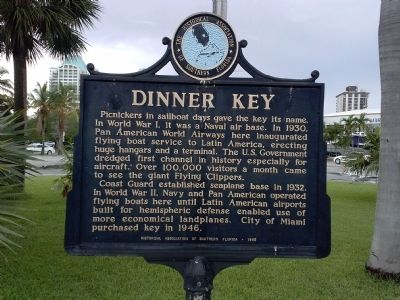
1. Dinner Key Marker
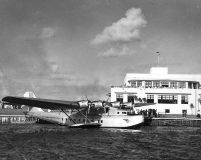
Inscription. Picnickers in sailboat days gave the key its name. In World War I, it was a Naval air base. In 1930, Pan American World Airways here inaugurated flying boat service to Latin America, erecting huge hangars and a terminal. The U.S. Government dredged first channel in history especially for aircraft. Over 100,000 visitors a month came to see the giant Flying Clippers.

Coast Guard established seaplane base in 1932. In World War II, Navy and Pan American operated flying boats here until Latin American airports built for hemispheric defense enabled use of more economical landplanes. City of Miami purchased key in 1946.
 
Erected 1953 by The Historical Association of Southern Florida.
 
Topics. This historical marker is listed in these topic lists: Air & SpaceWar, World IWar, World II. A significant historical year for this entry is 1930.
 
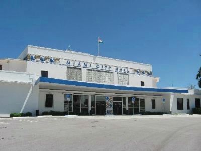
Location. 25° 43.684′ N, 80° 14.053′ W. Marker is in Miami, Florida, in Miami-Dade County. Marker is on Pan American Drive south of SW 27th Avenue, in the median. Marker is located in the circular drive in front of Miami City Hall. Touch for map. Marker is at or near this postal address: 3500 Pan American Drive, Miami FL 33133, United States of America. Touch for directions.
 
Other nearby markers. At least 8 other markers are within walking distance of this marker. NAS Miami Pan Am Seaplane Base (approx. 0.2 miles away); U.S. Coast Guard Station Hanger
Paid Advertisement
Click on the ad for more information.
Please report objectionable advertising to the Editor.
Click or scan to see
this page online
(approx. ¼ mile away); Housekeepers Club (approx. 0.4 miles away); Housekeepers-Womans Club of Coconut Grove (approx. 0.4 miles away); Coconut Grove Library (approx. 0.4 miles away); a different marker also named The Coconut Grove Library (approx. 0.4 miles away); David Thomas Kennedy Park (approx. half a mile away); The Barnacle (approx. 0.6 miles away). Touch for a list and map of all markers in Miami.
 
More about this marker. Formerly an island, Dinner Key is today the site of a marina complex and Miami City Hall. It was connected to the mainland by a road in 1914 for use as a training facility for the U.S. Navy in World War I. Dinner Key was the base of international operations for Pan Am's flying boats as well as a Naval airbase during World War II.
 
Dinner Key Marker image. Click for full size.
Photographed By Marsha A. Matson, July 6, 2014
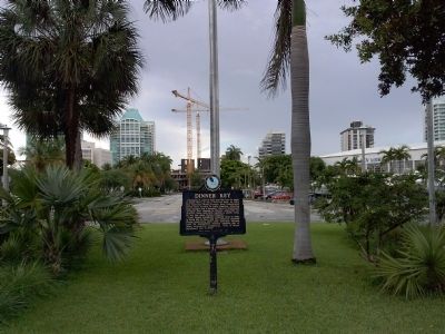
2. Dinner Key Marker
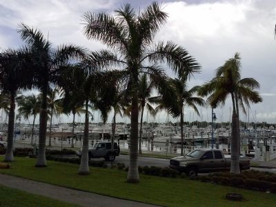
Dinner Key Marker with view of the Coconut Grove neighborhood of Miami in the background.
Miami City Hall image. Click for full size.
3. Miami City Hall
Miami City Hall was formerly the Pan American Airlines airport terminal, located on Dinner Key.
Dinner Key Marina image. Click for full size.
Photographed By Marsha A. Matson, July 6, 2014
4. Dinner Key Marina
Dinner Key Marina image. Click for full size.
Photographed By Marsha A. Matson, July 6, 2014
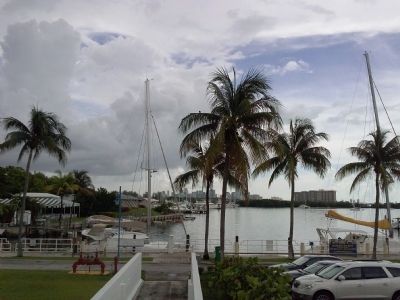
5. Dinner Key Marina
View of Miami skyline in distance
Pan American airplane at Dinner Key image. Click for full size.
State Archives of Florida, Florida Memory, http://floridamemory.com/items/show/560
6. Pan American airplane at Dinner Key
Aerial view of Dinner Key, 1934 image. Click for full size.
University of Miami Digital Exhibits. http://scholar.library.miami.edu/panam/dinner.html
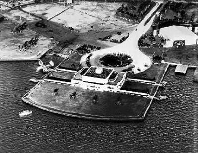
7. Aerial view of Dinner Key, 1934
An aerial view of the Pan Am Terminal at Dinner Key, Miami, Florida, in 1934. The building is the present day Miami City Hall.
Mosaic on front exterior of Miami City Hall image. Click for full size.
Photographed By Marsha A. Matson, July 6, 2014
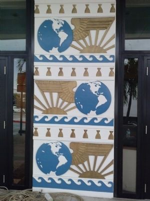
8. Mosaic on front exterior of Miami City Hall
 
 
Credits. This page was last revised on November 26, 2017. It was originally submitted on July 8, 2014, by Marsha A. Matson of Palmetto Bay, Florida. This page has been viewed 883 times since then and 49 times this year. Photos:   1, 2, 3, 4, 5, 6, 7, 8. submitted on July 8, 2014, by Marsha A. Matson of Palmetto Bay, Florida. • Bernard Fisher was the editor who published this page.
Share this page.  
Share on Tumblr
m=75186

CeraNet Cloud Computing sponsors the Historical Marker Database.
This website earns income from purchases you make after using our links to Amazon.com. We appreciate your support.
Paid Advertisement
Apr. 25, 2024