Lewisburg in Greenbrier County, West Virginia — The American South (Appalachia)
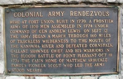
Colonial Army Rendezvous
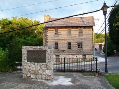
Here at Fort Union, built in 1770, a frontier army of 1100 men assembled in 1774 under command of Gen. Andrew Lewis. On Sept. 12, the army began a march through 160 miles of trackless wilderness to the mouth of the Kanawha River and defeated Cornstalk, gallant Shawnee Chief, and his warriors in the bloody Battle of Point Pleasant Oct. 10, 1774. The cabin home of Matthew Arbuckle famous pioneer scout who led the army, stood nearby.
Topics. This historical marker is listed in these topic lists: Colonial Era • Forts and Castles • Native Americans • Wars, US Indian. A significant historical month for this entry is September 1810.
Location. 37° 48.156′ N, 80° 26.684′ W. Marker is in Lewisburg, West Virginia, in Greenbrier County. Marker is at the intersection of Jefferson Street (U.S. 219) and Randolph Street, on the left when traveling north on Jefferson Street. Marker is near the southern boundary of General Andrew Lewis Park. Touch for map. Marker is in this post office area: Lewisburg WV 24901, United States of America. Touch for directions.
Other nearby markers. At least 8 other markers are within walking distance of this marker. Lewisburg Graded School Bell (within shouting distance of this marker); Greenbrier County Courthouse (about 300 feet away, measured in a direct line); Battle of Lewisburg (about 300 feet away); Tribute to Men of the Mountains (about 300 feet away); Greenbrier County War Memorial (about 300 feet away); Samuel Price (about 500 feet away); The Lewisburg Foundation (approx. 0.2 miles away); Shuck Memorial Baptist Church (approx. 0.2 miles away). Touch for a list and map of all markers in Lewisburg.
Related markers. Click here for a list of markers that are related to this marker.
Also see . . .
1. Battle of Point Pleasant. Point Pleasant WV website entry:
1927 Report by Livia Simpson-Poffenbarger (Submitted on July 8, 2014, by William Fischer, Jr. of Scranton, Pennsylvania.)
2. Point Plesant Battleground - National Register of Historic Places Nomination Form. West Virginia Department of Arts, Culture and History website entry (Submitted on January 26, 2022, by Larry Gertner of New York, New York.)
3. Brig Gen Andrew Lewis, Continental Army. Geni website entry (Submitted on July 8, 2014, by William Fischer, Jr. of Scranton, Pennsylvania.)
4. Chief Cornstalk. Dictionary of Virginia Biography website entry (Submitted on July 8, 2014, by William Fischer, Jr. of Scranton, Pennsylvania.)
Credits. This page was last revised on January 26, 2022. It was originally submitted on July 8, 2014, by William Fischer, Jr. of Scranton, Pennsylvania. This page has been viewed 519 times since then and 11 times this year. Photos: 1, 2. submitted on July 8, 2014, by William Fischer, Jr. of Scranton, Pennsylvania.

