Eau Claire in Eau Claire County, Wisconsin — The American Midwest (Great Lakes)
Eau Claire’s Connection to the Soo Line Railroad
Inscription.
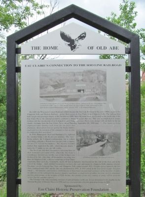
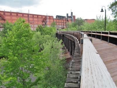
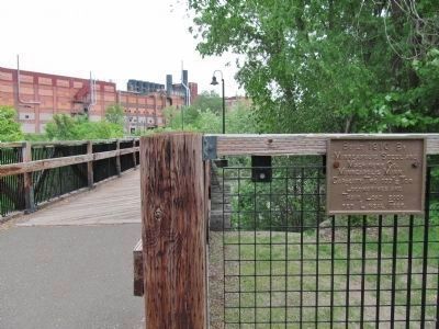
By 1889, the Wisconsin Central Railroad (which became the Soo Line Railroad in the early 1900’s) acquired the Chippewa Falls and Western Railway, giving them access to Eau Claire from Chippewa Falls. The railroad then built freight and passenger depots at this location in 1890. Since the main track was located on the north side of the Eau Claire River, the railroad needed to construct a bridge to access this site. This was accomplished in unique fashion with the construction of an S-shaped wooden bridge utilizing a Howe truss design with rail deck on the top chords. Accounts from the Eau Claire Press, dated Thursday, September 18, 1890 state, “… Five teams are being employed today hauling rock stone for the piers and abutments. About fifteen men are getting the bridge timbers ready and it is the intention of the company to lose no time in completing their new depot.”
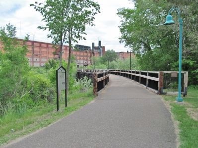
In 1910, Minneapolis Steel and Machinery Co. replaced the wooden bridge with the present structure. The “new” bridge utilizes the S-shaped configuration, but is a three span bridge utilizing a Warren truss design, with a capacity for two 177 ½ ton locomotives. The massive wooden timbers that supported the rails, which measure nearly 7 inches by 17 inches in size, are still visible.
The Soo Line did their locomotive servicing here in their terminal yard until 1925, when the Soo Line’s roundhouse (located just to the east of the bridge) was destroyed by fire. After that, all locomotive servicing was done in Chippewa Falls, with two round trips to Eau Claire originating there each day. A turntable, nearly 60 feet in diameter, was located on this side of the river, just to the east of the bridge, which enabled locomotives to leave the yard and return to Chippewa Falls running forward. Passenger service between Eau Claire and Chippewa Falls ended around 1931. Freight service between the two cities continued until 1987 and the line was abandoned in 1991. A 1953 article in the Eau Claire Leader Telegram stated “… All industries and business establishments in Eau Claire are potential customers of the Soo Line. It makes no difference to the railroad if the factory, foundry, warehouse or plant reeks of rubber, hot iron, steel or aluminum, packing plant aroma, or the perfume of Fifth Avenue. Any product of any size, coming or going, will be given the service that the customer expects.”
The S-bridge is the only remaining structure of railroad history at this site. It was determined to be eligible for the National Register of Historic Places in 1998 and was converted into a bicycle-pedestrian bridge in 2002.
by:
Eau Claire Historic Preservation Foundation
Erected 2003 by the City of Eau Claire Landmark Commission; Eau Claire Historic Preservation Foundation. (Marker Number 16.)
Topics. This historical marker is listed in these topic lists: Bridges & Viaducts • Railroads & Streetcars. A significant historical date for this entry is September 18, 1865.
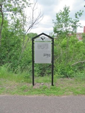
Location. 44° 48.823′ N, 91° 29.675′ W. Marker is in Eau Claire, Wisconsin, in Eau Claire County. Marker can be reached from South Dewey Street north of Gibson Street, on the right when traveling north. Marker is along the Galloway Street Trail. Touch for map. Marker is at or near this postal address: 610 Gibson Street, Eau Claire WI 54701, United States of America. Touch for directions.
Other nearby markers. At least 8 other markers are within walking distance of this marker. City Hall (approx. ¼ mile away); Eau Claire Public Library (approx. ¼ mile away); Eau Claire River (approx. 0.3 miles away); Schlegelmilch McDaniel Historic Home (approx. 0.3 miles away); Christ Church Cathedral and Parish House (approx. 0.3 miles away); "Haymarket Square" (approx. 0.4 miles away); Temple of Free Masonry (approx. 0.4 miles away); Old Abe of Co. C (approx. 0.4 miles away). Touch for a list and map of all markers in Eau Claire.
More about this marker. photo captions:
• 1976 Photo of Soo Line Property at S. Dewey & Gibson Streets, looking to the east. Freighthouse (left) constructed in 1890 – razed in 1993; Freight transfer & office building (right) constructed in 1925 replacing the original 1890 passenger depot – razed in 1997. A. R. Johnson Collection.
• 1979 Photo of S-bridge. Ted Schnepf Collection.
Also see . . .
1. Soo Line Historical and Technical Society. (Submitted on July 19, 2014.)
2. Soo Line Railroad. Wikipedia entry. (Submitted on July 19, 2014.)
3. Wisconsin Central Railway (1897–1954). Wikipedia entry. (Submitted on July 19, 2014.)
4. The Chicago, St. Paul, Minneapolis & Omaha. Eau Claire area maps and photos. (Submitted on July 19, 2014.)
Additional keywords. Minneapolis, St. Paul and Sault Ste. Marie Railroad
Credits. This page was last revised on June 16, 2016. It was originally submitted on July 19, 2014, by Keith L of Wisconsin Rapids, Wisconsin. This page has been viewed 897 times since then and 61 times this year. Photos: 1, 2, 3, 4, 5. submitted on July 19, 2014, by Keith L of Wisconsin Rapids, Wisconsin.
