Canton in Haywood County, North Carolina — The American South (South Atlantic)
Locust Field Cemetery
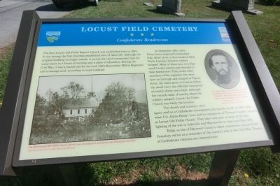
Confederate Rendezvous
In September 1863, when Union forces captured Cumberland Gap, about three or four hundred 62nd North Carolina Infantry soldiers escaped. Many of these men were Haywood County natives and returned to their homes here. They joined other members of the regiment who were here on furlough and camped at Pigeon River, the name given to Canton before the small town was officially incorporated nearly thirty years later. Although few records exist of exactly where the soldiers camped, Locust Old Fields Church was likely the location.
The church and cemetery were again used as a Confederate encampment during the winter of 1864-1865, when Col. James Robert Love and six companies of Thomas’s Legion camped at Locust Old Fields Church. They later took park in some of the last fighting of the war in Asheville and Waynesville in April and May 1865.
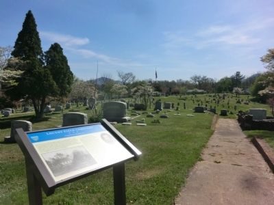
Today, as one of Haywood County’s oldest cemeteries, Locust Field Cemetery serves as a reminder of the county’s role in the Civil War. Dozens of Confederate veterans are interred here.
(captions)
(lower left) The first Locust Old Fields Church served as an encampment and muster site during the Civil War. Courtesy of the Canton Area Historical Museum
(upper right) Col. James Robert Love, Thomas’s Legion, and his men wintered on Locust Old Fields Church in 1864-1865 before fighting in some of the last battles of the Civil War. Courtesy North Carolina Office of Archives and History
Erected by North Carolina Civil War Trails.
Topics and series. This historical marker is listed in these topic lists: Cemeteries & Burial Sites • Churches & Religion • War, US Civil. In addition, it is included in the North Carolina Civil War Trails series list. A significant historical month for this entry is May 1865.
Location. 35° 31.762′ N, 82° 50.084′ W. Marker is in Canton, North Carolina, in Haywood County. Marker is at the intersection of Locust Street and Pennsylvania Avenue, on the left when traveling south on Locust Street. Touch for map. Marker is at or near this postal address: 11 Pennsylvania Ave, Canton NC 28716, United States of America. Touch for directions.
Other nearby markers. At least 8 other markers are within 4 miles of this marker, measured as the crow flies. Arnold Guyot (approx. 0.3 miles away); Morning Star Church (approx. 0.3 miles away); Colonial Theatre (approx. 0.4 miles away); Haywood County World War II Monument (approx. 0.4 miles away); The Canton Area History Museum (approx. 0.4 miles away); Rutherford Trace (approx. 1.4 miles away); Garden Creek (approx. 1.6 miles away); Osborne Boundary Oak Tree (approx. 3.1 miles away). Touch for a list and map of all markers in Canton.
Credits. This page was last revised on June 16, 2016. It was originally submitted on July 20, 2014, by Don Morfe of Baltimore, Maryland. This page has been viewed 861 times since then and 54 times this year. Photos: 1, 2. submitted on July 20, 2014, by Don Morfe of Baltimore, Maryland. • Bernard Fisher was the editor who published this page.

