Meadow in Millard County, Utah — The American Mountains (Southwest)
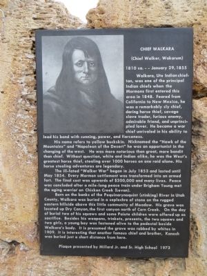
Chief Walkara
(Chief Walker, Wakarum)
— 1810 ca. - - - - January 29, 1855 —
His name refers to yellow buckskin. Nicknamed the "Hawk of the Mountains" and "Napoleon of the Desert" he was an opportunist in the changing of the west. He was more notorious than great, more bandit than chief. Without question, white and Indian alike, he was the West's greatest horse thief, stealing over 1000 horses on one raid alone. His horse stealing adventures are legendary.
The ill-fated "Walker War" began in July 1853 and lasted until May 1854. Every Mormon settlement was transformed into an armed fort. The final cost was upward of $200,000 and many lives. Peace was concluded after a mile-long peace train under Brigham Young met the aging warrior on Chicken Creek (Levan).
Born on the banks of the Pequinarynoquint (Stinking) River in Utah County, Walkara was buried in a seplechre of stone on the rugged eastern hillside above this little community of Meadow. His grave was located up Dry Canyon, the first canyon north of Corn Creek. On the day of burial two of his squaws and some Paiute children were offered up as sacrifice. Besides his weapons, trinkets, presents, the two squaws and two girls, a young boy was fastened alive to the pedestal beside Walkara's body. It is presumed the grave was robbed by whites in 1909. It is interesting that another famous chief and brother, Kanosh was buried just a short distance from here.
Erected 1973 by Millard Jr. and Sr. High School.
Topics. This historical marker is listed in these topic lists: Native Americans • Wars, US Indian. A significant historical year for this entry is 1848.
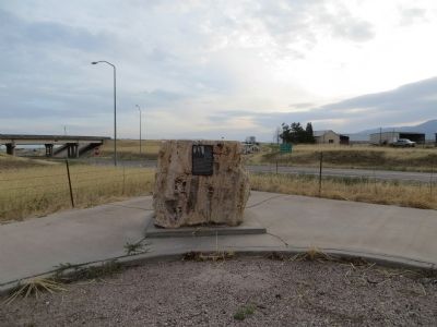
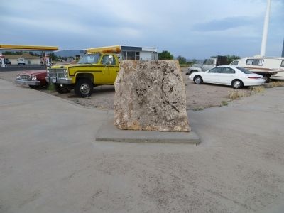
Location. 38° 53.547′ N, 112° 24.691′ W. Marker is in Meadow, Utah, in Millard County. Marker is at the intersection of North Main Street and Interstate 15, on the right when traveling south on North Main Street. Back of monument is visible from North Main Street. You will have to enter the Chevron parking lot to view the marker. Touch for map. Marker is in this post office area: Meadow UT 84644, United States of America. Touch for directions.
Other nearby markers. At least 8 other markers are within 7 miles of this marker, measured as the crow flies. Settlement of Meadow (approx. half a mile away); Taysom Cabin (approx. 0.7 miles away); 1867 Chief Kanosh Memorial 1976 (approx. 6.4 miles away); Kanosh (approx. 6.4 miles away); Edward Partridge, Jr. House (approx. 6.9 miles away); Little Rock Schoolhouse (approx. 6.9 miles away); Land of the Yuta (approx. 7 miles away); Utah’s First Capitol (approx. 7 miles away). Touch for a list and map of all markers in Meadow.
Credits. This page was last revised on June 16, 2016. It was originally submitted on July 20, 2014, by Bill Kirchner of Tucson, Arizona. This page has been viewed 1,333 times since then and 122 times this year. Photos: 1, 2, 3, 4. submitted on July 20, 2014, by Bill Kirchner of Tucson, Arizona. • Syd Whittle was the editor who published this page.


