Eau Claire in Eau Claire County, Wisconsin — The American Midwest (Great Lakes)
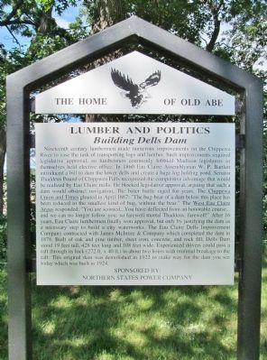
Lumber and Politics
Building Dells Dam
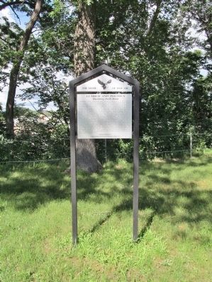
Nineteenth century lumbermen made numerous improvements on the Chippewa River to ease the task of transporting logs and lumber. Such improvements required legislative approval, so lumbermen commonly lobbied Madison legislators or themselves held elective office. In 1860 Eau Claire Assemblyman W. P. Bartlett introduced a bill to dam the lower dells and create a huge log holding pond. Senator Thaddeus Pound of Chippewa Falls recognized the competitive advantage that would be realized by Eau Claire mills. He blocked legislative approval, arguing that such a dam would obstruct navigation. The bitter battle raged for years. The Chippewa Union and Times gloated in April 1867: "The bug-bear of a dam below this place has been reduced to the smallest kind of bug, without the bear." The West Eau Claire Argus responded: "You are scorned...You have deflected from an honorable course...and we can no longer follow you: so farewell mortal Thaddeus, farewell!" After 16 years, Eau Claire lumbermen finally won approval, but only by justifying the dam as a necessary step to build a city waterworks. The Eau Claire Dells Improvement Company contracted with James McIntire & Company which completed the dam in 1878. Built of oak and pine timber, sheet iron, concrete, and rock fill, Dells Dam stood 19 feet tall, 428 feet long and 108 feet wide. Experienced drivers could pass a raft through its lock (272 ft. x 40 ft.) in about two hours with minimal breakage to the raft. This original dam was demolished in 1922 to make way for the dam you see today which was built in 1924.
Northern States Power Company
Erected by the City of Eau Claire Landmark Commission; Northern States Power Company. (Marker Number 13.)
Topics. This historical marker is listed in these topic lists: Government & Politics • Industry & Commerce • Man-Made Features • Waterways & Vessels. A significant historical month for this entry is April 1867.
Location. 44° 49.607′ N, 91° 30.733′ W. Marker is in Eau Claire, Wisconsin, in Eau Claire County. Marker is on First Street north of Bolles Street, on the right when traveling north. Touch for map. Marker is in this post office area: Eau Claire WI 54701, United States of America. Touch for directions.
Other nearby markers. At least 8 other markers are within one mile of this marker, measured as the crow flies. Walter-Heins (approx. 0.7 miles away); Eichert - Pscheidt (approx. ¾ mile away); Waldemar Ager House (approx. ¾ mile away); "The Log Flume" (approx. 0.9 miles away); The "Flume" (approx. one mile away); City of Bridges (approx. one mile away); Luther Midelfort: A History of Caring (approx. 1.1 miles away); Eau Claire River (approx. 1.1 miles away). Touch for a list and map of all markers in Eau Claire.
Also see . . .
1. Dells Dam. (Submitted on July 23, 2014.)
2. History of Eau Claire County Wisconsin. (Submitted on July 23, 2014.)
3. Dells Hydro Generating Station. "In 1924, a new dam was completed 100 feet downstream from the original structure. The city of Eau Claire owned the dam itself and the larger of the two powerhouses on the site until Xcel Energy purchased it in 2003.... During major maintenance work in 1979 the water level in Dells Pond was lowered more than 20 feet giving area residents a rare opportunity to see the original dam still standing upstream of the new one." (Submitted on July 23, 2014.)
Credits. This page was last revised on June 25, 2017. It was originally submitted on July 23, 2014, by Keith L of Wisconsin Rapids, Wisconsin. This page has been viewed 501 times since then and 24 times this year. Photos: 1, 2, 3, 4. submitted on July 23, 2014, by Keith L of Wisconsin Rapids, Wisconsin.


