Ogdensburg in St. Lawrence County, New York — The American Northeast (Mid-Atlantic)
North Country Sailors' Memorial
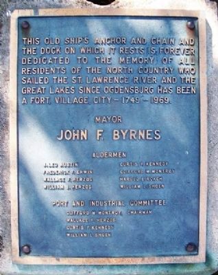
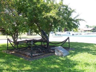
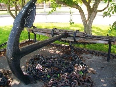
This old ship's anchor and chain and the dock on which it rests is forever dedicated to the memory of all residents of the North Country who sailed the St. Lawrence River and the Great Lakes since Ogdensburg has been a fort, village, city - 1749 - 1969.
——————————
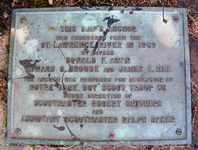
This ship's anchor was recovered from the
St. Lawrence River in 1969
by divers
Donald F. Awan, Edward B. Brouse
and James E. Mee
The anchor was prepared for dedication by
Notre Dame Boy Scout Troop 68
under direction of
Scoutmaster Robert Smithers
and
Assistant Scoutmaster Ralph Baker
Erected 1969.
Topics. This historical marker and memorial is listed in these topic lists: Man-Made Features • Settlements & Settlers • Waterways & Vessels. A significant historical year for this entry is 1749.
Location. 44° 42.045′ N, 75° 29.702′ W. Marker is in Ogdensburg, New York, in St. Lawrence County. Marker is in the circle in the Morissette Park parking lot at the north end of Caroline Street, along the St. Lawrence River. Touch for map. Marker is in this post office area: Ogdensburg NY 13669, United States of America. Touch for directions.
Other nearby markers. At least 8 other markers are within walking distance of this marker. What Happened To The Patriots (within shouting distance of this marker); Benjamin Forsyth: The Daring Commando (within shouting distance of this marker); Ogdensburgh And The War (within shouting distance of this marker); The Attack on the Village (about 400 feet away, measured in a direct line); Sheriff Joseph York’s Stand (about 400 feet away); Attack on the Fort (about 500 feet away); Civil War Soldiers' and Sailors' Memorial (about 600 feet away); How Ogdensburgh Captured Brockville (about 600 feet away). Touch for a list and map of all markers in Ogdensburg.
Also see . . .
1. St. Lawrence Seaway - A Vital Waterway. The Great Lakes - St. Lawrence Seaway System website (Submitted on July 26, 2014, by William Fischer, Jr. of Scranton, Pennsylvania.)
2. St. Lawrence Seaway History. St Lawrence Piks entry (Submitted on July 26, 2014, by William Fischer, Jr. of Scranton, Pennsylvania.)
Credits. This page was last revised on February 13, 2021. It was originally submitted on July 26, 2014, by William Fischer, Jr. of Scranton, Pennsylvania. This page has been viewed 335 times since then and 12 times this year. Photos: 1, 2, 3, 4. submitted on July 26, 2014, by William Fischer, Jr. of Scranton, Pennsylvania.


