Fort Montgomery in Orange County, New York — The American Northeast (Mid-Atlantic)
The Battle Around the Redoubts
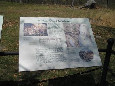
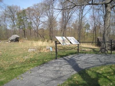
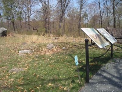
Brigadier General George Clinton, the Governor of New York State, commanded Fort Montgomery during the battle of October 6, 1777. Aware the British were approaching, he ordered some of his men to take a 3-pounder cannon down the western road leading to the fort to slow the enemy. The Americans temporarily stopped the 900 advancing British and Loyalist soldiers under the command of Lieutenant Colonel Mungo Campbell, but were eventually forced to abandon their gun and return to the fort.
As Governor Clinton was rallying his men to continue the fight, a roaring cheer went up from Fort Clinton, proclaiming its capture by the British. Governor Clinton and more than half of the Americans escaped from Fort Montgomery, taking advantage of the battle’s haze and the growing darkness. By nightfall, the British controlled both forts, and the Battle of Fort Montgomery was over. All subsequent testimonies by the officers agreed that the soldiers had fought bravely, but that there simply had not been enough men to defend the forts adequately.
Erected by Fort Montgomery State Historic Site.
Topics. This historical marker is listed in these topic lists: Forts and Castles • War, US Revolutionary. A significant historical date for this entry is October 6, 1777.
Location. 41° 19.55′ N, 73° 59.254′ W. Marker is in Fort Montgomery, New York, in Orange County. Marker can be reached from U.S. 9W, on the right when traveling north. Marker is in Fort Montgomery State Historic Site on the walking trail, near Route 9W. Touch for map. Marker is in this post office area: Fort Montgomery NY 10922, United States of America. Touch for directions.
Other nearby markers. At least 8 other markers are within walking distance of this marker. North Redoubt (here, next to this marker); Barracks (within shouting distance of this marker); Fort Montgomery (within shouting distance of this marker); Enlisted Men’s & Officers’ Barracks (within shouting distance of this marker); Soldiers’ Necessary (about 300 feet away, measured in a direct line); Guard House (about 400 feet away); Powder Magazine (about 500 feet away); Welcome to Fort Montgomery (about 600 feet away). Touch for a list and map of all markers in Fort Montgomery.
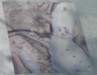
More about this marker. The upper right portion of the map contains a map of Forts Clinton and Montgomery during the battle. It contains the caption “When Lieutenant Colonel Mungo Campbell was killed leading the British attack on Fort Montgomery, command passed to Beverly Robinson, a wealthy Loyalist. Robinson’s Loyal American Regiment, the Regiment of New York Volunteers, and Emmerich's Chasseurs (riflemen drawn from other Loyalist regiments) attacked this redoubt, while British regulars attacked the other ones.”
Plan of the Attack…by John Hill. Courtesy New York State Library.
Under this is a painting by Jack Mead with the caption “After the British began the attack, they flew a flag offering good treatment if the Americans would surrender. Governor Clinton sent Lieutenant Colonel William Livingston to receive the offer. Livingston refused to surrender, but made a similar offer to the British. They also refused, and the fighting resumed.”
The upper left of the marker features a painting of the British attack on the redoubt. It has the caption “According to most accounts, the Battle of Fort Montgomery raged around the fort’s three redoubts. The Americans repulsed the British several times before they were driven from the redoubts. This illustration by Jack Mead depicts the storming of a redoubt.”
The marker also contains a picture of soldiers transporting the 3-pounder cannon, with the caption “According to at least one account, the brass 3-pounder taken out to delay the British, burnt during the fighting. Other accounts, however, indicate the Americans spiked it before abandoning it rendering it useless.”
Related markers. Click here for a list of markers that are related to this marker. This series of markers follow the walking tour of the Fort Montgomery Battlefield.
Also see . . . The Battle of Fort's (sic) Montgomery and Clinton
. The American Revolutionary War website entry (Submitted on May 4, 2008, by Bill Coughlin of Woodland Park, New Jersey.)
Credits. This page was last revised on August 19, 2021. It was originally submitted on May 4, 2008, by Bill Coughlin of Woodland Park, New Jersey. This page has been viewed 1,246 times since then and 36 times this year. Photos: 1, 2, 3, 4. submitted on May 4, 2008, by Bill Coughlin of Woodland Park, New Jersey. • Kevin W. was the editor who published this page.


