Niagara Falls in Niagara Region, Ontario — Central Canada (North America)
Indian Ossuary
Inscription.
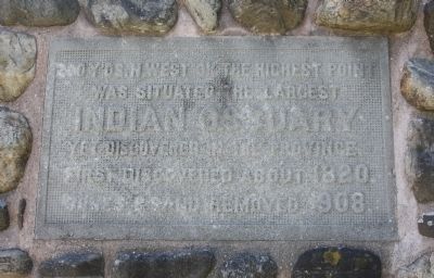
200 yards north west of the highest point was situated the largest Indian Ossuary yet discovered in the Province. First discovered in 1828. Bones and sand removed in 1908.
Erected 1934 by Niagara Falls Canada.
Topics. This historical marker is listed in these topic lists: Cemeteries & Burial Sites • Native Americans. A significant historical year for this entry is 1828.
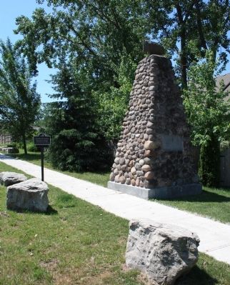
Location. 43° 8.308′ N, 79° 6.083′ W. Marker is in Niagara Falls, Ontario, in Niagara Region. Marker is at the intersection of St. Paul Avenue and Pinestone Road, on the left when traveling north on St. Paul Avenue. This historical marker is on the southwest corner of the intersection, and is situated next to a large cairn. Touch for map. Marker is in this post office area: Niagara Falls ON L2J 4L1, Canada. Touch for directions.
Other nearby markers. At least 8 other markers are within 3 kilometers of this marker, measured as the crow flies. Stamford Cottage (here, next to this marker); Niagara Portage Road (approx. 1.4 kilometers away); Headquarters of DeRottenberg (approx. 2.2 kilometers away); The Burning of St. Davids 1814 (approx. 2.2 kilometers away); Buried Railway Trestle and Buried Gorge (approx. 2.5 kilometers away); Niagara Falls Park and River Railway (approx. 2.6 kilometers away); Sheaffe's Path to Victory (approx. 2.7 kilometers away); Niagara River Recreation Trail (approx. 2.8 kilometers away). Touch for a list and map of all markers in Niagara Falls.
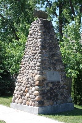
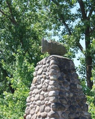
More about this marker. This historical marker is actually two markers for the same historical feature. The original marker was part of a large stone cairn, with the text inscribed on a flat, cut stone slab, imbedded within the north face of the stone cairn. But since the inscription has become somewhat weather worn, it would seem that an additional metal historical marker, facing north, with a near identical text, was added to the site of this historical marker.
Regarding Indian Ossuary. Upon visiting the Ontario's Historical Plaques website, some additional facts regarding this historical marker can be discovered and some additional vintage pictures can be viewed. Apparently, at one point in time, the Stamford Cottage text, on the south side of the cairn, was covered up by a related historical plaque that was sponsored by the Ontario Archaeological and Historic Sites Board. However, sometime between a photo dated from 1987 and another photo dated 1989 this plaque went missing.
The information provided at this website
also indicates that there is evidence that the cairn was moved from its original site when the subdivision was developed. The original location is not currently known, so the original distances detailed in the text of this marker would be skewed.

Photographed By Dale K. Benington, June 10, 2012
3. Indian Ossuary Marker
View of the text (weather worn) on the north face of the cairn, which closely reflects the text on the featured historical marker, stating:"200 y'ds n west of the highest point was situated the largest INDIAN OSSUARY yet discovered in the province. First discovered about 1820. Bones and sand removed 1908."
Credits. This page was last revised on September 27, 2019. It was originally submitted on June 25, 2013, by Dale K. Benington of Toledo, Ohio. This page has been viewed 744 times since then and 45 times this year. Last updated on August 2, 2014, by Anton Schwarzmueller of Wilson, New York. Photos: 1, 2, 3, 4, 5. submitted on June 25, 2013, by Dale K. Benington of Toledo, Ohio. • Bill Pfingsten was the editor who published this page.


