Ogdensburg in St. Lawrence County, New York — The American Northeast (Mid-Atlantic)
The Battle of Ogdensburg
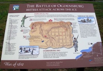
British Attack Across the Ice
— War of 1812 —
February 22, 1813
British Lieutenant Colonel "Red" George Macdonnell led a force of about 650 soldiers and artillery across the ice to attack the American garrison at Ogdensburg commanded by Captain Benjamin Forsyth. Macdonnell moved to put an end to American raids across the river.
[Map highlights]
1. Two columns leave Prescott to march on Ogdensburg. One is hauling artillery on sleighs. Macdonnell's column makes a frontal assault on the town near the unfinished Fort Oswegatchie.
2 Captain Jenkins of the Royal Artillery leads the artillery column toward Fort Presentation and the gun positions on the point.
3. Macdonnell's troops fight their way through the settlement and capture American artillery.
4. American artillery drives Jenkins' force back to Prescott from where they join Macdonnell's advance.
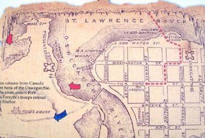
5. The larger main column from Canada reaches the east bank of the Oswegatchie, and crossing the river, enters Fort Presentation as Forsyth's troops retreat toward Sackets Harbor.
The American Fort Oswegatchie, never completed, was on the shore bounded by Washington, Franklin and Elizabeth Streets.
Through the Drifts
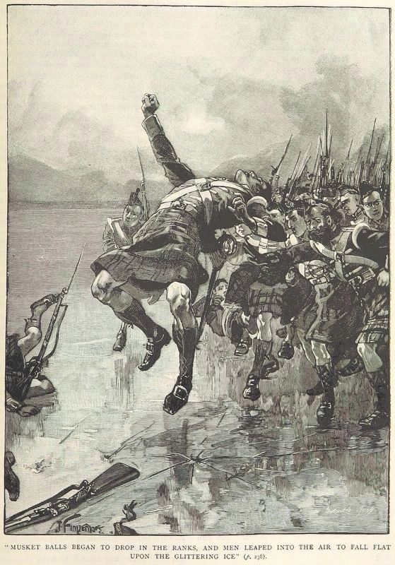
The advance of the British regulars and Canadian militia was hampered by the snow drifted on the St. Lawrence, as well as the musket and artillery fire from American positions. However, the attackers succeeded in overrunning the guns and driving the American defenders through the streets. The victors burned several schooners and gunboats frozen in the harbor, captured 11 artillery pieces, and arms, ammunition and military supplies. What could not be removed was destroyed.
Ogdensburg 1813
In 1813 Fort Presentation was abandoned and no American forces garrisoned the town for the duration of the war. The Town of Ogdensburg thrived on the east back [sic - bank] of the river thanks to contraband trade with Canada.
Fort Presentation was named by the Americans in honor of Fort de la Présentation founded on the site by the French in 1749. From 1760 to 1796 it was called Fort Oswegatchie while under British control. By 1812 Fort Presentation was in disrepair; Forsyth established his artillery in positions outside the fort.
Events Leading to the Battle
1813
February 22nd - Macdonnell launches his successful two-prong assault against Ogdensburg. Before withdrawing, British troops and some civilians plunder the town
February 19th - Lt. Col. Macdonnell demands the return of civilian goods and an end to American raids into Canadian villages. He is answered with insults.
February 7th - Crossing the river from Morristown, Forsyth retaliates by freeing the prisoners, taking more than 50 locals hostage and capturing a supply of arms.
February 4th - British forces cross the river, capture a handful of American civilians and troops, and retire to Elizabethtown (Brockville).
1812
October 4th - Responding to the 1st US Rifle's [sic - Rifles'] raid on Gananoque September 21st, Col. Robert Lethbridge, commanding at Prescott, leads an ill-fated amphibious assault on Ogdensburg.
Summer - American Captain Forsyth and his company of the 1st US Rifles are stationed in Ogdensburg to observe British movements on the St. Lawrence River.
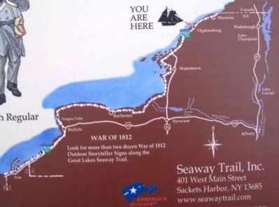
Erected by Great Lakes Seaway Trail.
Topics and series. This historical marker is listed in these topic lists: Forts and Castles • Patriots & Patriotism • War of 1812 • Waterways & Vessels. In addition, it is included in the Great Lakes Seaway Trail National Scenic Byway series list. A significant historical date for this entry is February 22, 1813.
Location. 44° 41.667′ N, 75° 30.073′ W. Marker is in Ogdensburg, New York, in St. Lawrence County. Marker is on the Downtown Arterial (New York State Route 68) west of Commerce Street, on the right when traveling west. Touch for map. Marker is in this post office area: Ogdensburg NY 13669, United States of America. Touch for directions.
Other nearby markers. At least 8 other markers are within walking distance of this marker. Fort la Présentation (here, next to this marker); Fort de la Présentation - 1749-1759 (here, next to this marker); Fort Lévis - 1760 (here, next to this marker); Fort Oswegatchie 1760-1796 (here, next to this marker); Aka Se We':Ka Tsi (Oswegatchie) (here, next to this marker); Fort de la Présentation (here, next to this marker); Abbe Picquet 1708 -1781 (about 400 feet away, measured in a direct line); Mission Fort (about 500 feet away). Touch for a list and map of all markers in Ogdensburg.
Also see . . .
1. The Battle of Ogdensburg. WCNY entry (Submitted on August 2, 2014, by William Fischer, Jr. of Scranton, Pennsylvania.)
2. The Battle of Ogdensburg. The Canadian Encyclopedia entry (Submitted on August 2, 2014, by William Fischer, Jr. of Scranton, Pennsylvania.)
3. The Battle of Ogdensburg. Wikipedia entry (Submitted on August 2, 2014, by William Fischer, Jr. of Scranton, Pennsylvania.)
Credits. This page was last revised on February 8, 2021. It was originally submitted on August 2, 2014, by William Fischer, Jr. of Scranton, Pennsylvania. This page has been viewed 726 times since then and 55 times this year. Photos: 1, 2. submitted on August 2, 2014, by William Fischer, Jr. of Scranton, Pennsylvania. 3. submitted on July 28, 2014, by William Fischer, Jr. of Scranton, Pennsylvania. 4. submitted on February 8, 2021, by Larry Gertner of New York, New York. 5. submitted on August 2, 2014, by William Fischer, Jr. of Scranton, Pennsylvania.
