Cahaba in Dallas County, Alabama — The American South (East South Central)
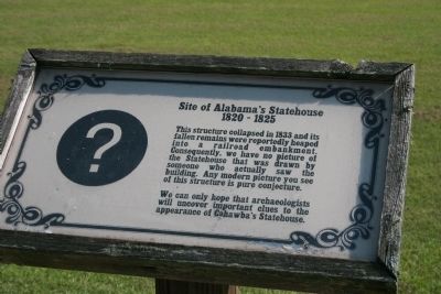
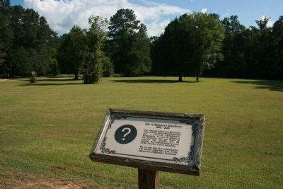
Site of Alabama's Statehouse
1820 - 1825
We can only hope that archaeologists will uncover important clues to the appearance of Cahawba's Statehouse.
Erected by Alabama Historical Commission.
Topics and series. This historical marker is listed in these topic lists: Anthropology & Archaeology • Railroads & Streetcars • Settlements & Settlers. In addition, it is included in the Alabama Historical Commission series list. A significant historical year for this entry is 1833.
Location. This marker has been replaced by another marker nearby. 32° 19.044′ N, 87° 5.838′ W. Marker is in Cahaba, Alabama, in Dallas County. Marker is on Capitol Avenue, on the right when traveling east. Touch for map. Marker is at or near this postal address: 68-82 Capitol Avenue, Orrville AL 36767, United States of America. Touch for directions.
Other nearby markers. At least 8 other markers are within walking distance of this location. Alabama's First Statehouse (a few steps from this marker); Cahaba First State Capital (within shouting distance of this marker); Working on Walnut Street (within shouting distance of this marker); Welcome to Downtown Cahawba (within shouting distance of this marker); The Mound at Old Cahawba Archaeological Park (within shouting distance of this marker); Railroad Depot and Commissary (about 300 feet away, measured in a direct line); Cahawba - circa 1500 (about 300 feet away); Footprint of a Church (about 300 feet away). Touch for a list and map of all markers in Cahaba.
More about this marker. This marker was replaced by a new one named Alabama's First Statehouse (see nearby markers).
Also see . . . Old Cahawba, "Alabama's most famous Ghost Town". (Submitted on September 21, 2009, by Timothy Carr of Birmingham, Alabama.)
Credits. This page was last revised on September 29, 2020. It was originally submitted on September 21, 2009, by Timothy Carr of Birmingham, Alabama. This page has been viewed 2,065 times since then and 33 times this year. Last updated on August 3, 2014, by Mark Hilton of Montgomery, Alabama. Photos: 1, 2. submitted on September 21, 2009, by Timothy Carr of Birmingham, Alabama. • Bernard Fisher was the editor who published this page.

