Fort Montgomery in Orange County, New York — The American Northeast (Mid-Atlantic)
Round Hill Redoubt
Erected by Fort Montgomery State Historic Site.
Topics. This historical marker is listed in these topic lists: Forts and Castles • Military • Notable Events • Notable Places • War, US Revolutionary.
Location. 41° 19.563′ N, 73° 59.397′ W. Marker is in Fort Montgomery, New York, in Orange County. Marker is in Fort Montgomery State Historic Site, west of Route 9W. Touch for map. Marker is in this post office area: Fort Montgomery NY 10922, United States of America. Touch for directions.
Other nearby markers. At least 8 other markers are within walking distance of this marker. A different marker also named Round Hill Redoubt (a few steps from this marker); Welcome to Fort Montgomery (about 300 feet away, measured in a direct line); West Redoubt (about 500 feet away); Fort Montgomery (about 600 feet away); North Redoubt (about 700 feet away); The Battle Around the Redoubts (about 700 feet away); Enlisted Men’s & Officers’ Barracks (about 700 feet away); Barracks (about 700 feet away). Touch for a list and map of all markers in Fort Montgomery.
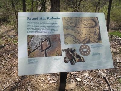
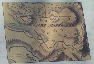
More about this marker. The upper right of the marker features an “18th century British map show[ing] Fort Montgomery’s three redoubts. All of the trees immediately surrounding the fort would have been removed. Thus, the men in those redoubts would have been able to support each other when attacked. Courtesy Library of Congress.”
The bottom left of the marker contains a “photograph of the model in Fort Montgomery visitor center show[ing] how the “Round Hill” redoubt may have looked. Its location on the high ground gave it a commanding position over the approach to the fort from the west.”
The bottom of the marker features pictures of a iron cannon wheel and the garrison cannon to which it belonged. The wheel has a caption of “Archeological explorations of this redoubt in the 1950s revealed three iron cannon wheels from a garrison carriage. The fourth wheel was never found.”
The cannon has the caption “This illustration depicts a typical garrison carriage with the iron wheels discovered in this redoubt.”
Related markers. Click here for a list of markers that are related to this marker. This series of markers follow the walking tour of the Fort Montgomery Battlefield.
Also see . . .
1. Fort Montgomery State Historic Site. New York State Parks, Recreation and Historic Preservation website entry (Submitted on May 4, 2008, by Bill Coughlin of Woodland Park, New Jersey.)
2. The Battle of Fort's (sic) Montgomery and Clinton. The American Revolutionary War website entry (Submitted on May 4, 2008, by Bill Coughlin of Woodland Park, New Jersey.)
Photographed By Bill Coughlin, April 23, 2008
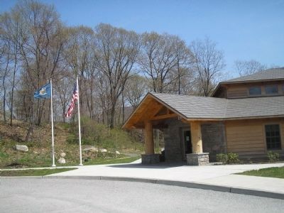
5. Fort Montgomery State Historic Site Visitor Center
Fort Montgomery preserves the site of the Revolutionary War Fort. It contains actual foundations of the fort's buildings and remains of earthworks. Archeological artifacts recovered from Forts Montgomery and Clinton during the 20th century are on display in the Visitor Center.
Credits. This page was last revised on August 18, 2021. It was originally submitted on May 4, 2008, by Bill Coughlin of Woodland Park, New Jersey. This page has been viewed 1,178 times since then and 11 times this year. Photos: 1, 2, 3, 4, 5. submitted on May 4, 2008, by Bill Coughlin of Woodland Park, New Jersey. • Kevin W. was the editor who published this page.
