Port Huron in St. Clair County, Michigan — The American Midwest (Great Lakes)
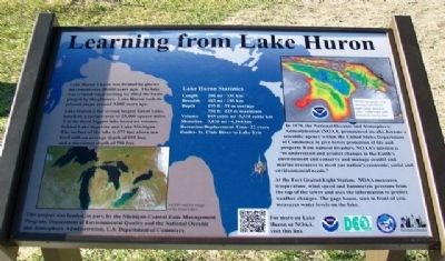
Learning from Lake Huron
Lake Huron's basin was formed by glacier movement over 20,000 years ago. The lake was created when melting ice filled the basin gouged by the glaciers. Lake Huron took its present shape around 3,000 years ago.
Lake Huron is the second largest Great Lake, based on a subsurface area of 23,000 square miles. It is the third biggest lake based on volume, behind Lake Superior and Lake Michigan. The surface of the lake is 577 feet above sea level with an average depth of 195 feet, and a maximum depth of 750 feet.
In 1970, the National Oceanic and Atmospheric Administration (NOAA, pronounced no-ah), became a scientific agency within the United States Department of Commerce to give better protection of life and property from natural disasters. NOAA's mission is "to understand and conserve and manage coastal and marine resources to meet our nation's economic, social and environmental needs."
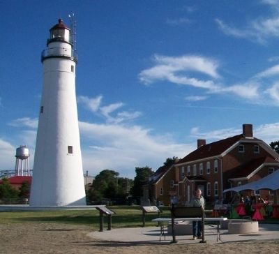
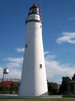
At the Fort Gratiot Light Station, NOAA measures temperature, wind speed and barometric pressure from the top of the tower and uses the information to predict weather changes. The gage house, seen in front of you, measures water levels on the lake.
Lake Huron Statistics
Length - 206 mi / 332 km
Breadth - 183 mi /295 km
Depth - 195 ft / 59 m average
750 ft / 229 m maximum
Volume - 849 cubic mi / 3,538 cubic km
Shoreline - 3,830 mi / 6,164 km
[Water] Retention/Replacement Time - 22 years
Outlet - St. Clair River to Lake Erie
[Top right photo caption reads]
NOAA topography map showing Lake Huron depth range, based on color. Underwater land formations can be seen.
[Bottom left photo caption reads]
MODIS satellite image of the Great Lakes
This project was funded, in part, by the Michigan Coastal Zone Management Program, Department of Environmental Quality and the National Oceanic and Atmospheric Administration, U.S. Department of Commerce
Erected by Port Huron Museum, Saint Clair County, Michigan Dept of Environmental Quality, and NOAA.
Topics. This historical marker is listed in these topic lists: Education • Environment • Science & Medicine • Waterways & Vessels. A significant historical year for this entry is 1970.
Location. 43° 0.4′ N, 82° 25.347′ W. Marker is in Port Huron, Michigan, in St. Clair County. Marker is about 125 feet north of the lighthouse at Fort Gratiot Light Station County Park, where Lake Huron empties into the St. Clair River. Touch for map. Marker is at or near this postal address: 2800 Omar Street, Port Huron MI 48060, United States of America. Touch for directions.
Other nearby markers. At least 8 other markers are within walking distance of this marker. Seeing the Light (here, next to this marker); The Storm (here, next to this marker); Sending a Signal (here, next to this marker); Keepers Duties (here, next to this marker); Fort Gratiot Light (here, next to this marker); U.S. Coast Guard (about 500 feet away, measured in a direct line); a different marker also named Fort Gratiot Light (about 500 feet away); Great Storm of 1913 and Sailors Memorial (approx. 0.4 miles away). Touch for a list and map of all markers in Port Huron.
Also see . . .
1. The Canadian Perspective on Lake Huron. Canadian Encyclopedia website entry (Submitted on August 8, 2014, by William Fischer, Jr. of Scranton, Pennsylvania.)
2. Lake Huron at National Weather Service, NOAA. (Submitted on August 8, 2014, by William Fischer, Jr. of Scranton, Pennsylvania.)
Credits. This page was last revised on December 23, 2022. It was originally submitted on August 8, 2014, by William Fischer, Jr. of Scranton, Pennsylvania. This page has been viewed 409 times since then and 12 times this year. Photos: 1, 2, 3. submitted on August 8, 2014, by William Fischer, Jr. of Scranton, Pennsylvania.


