Port Huron in St. Clair County, Michigan — The American Midwest (Great Lakes)
Sending a Signal
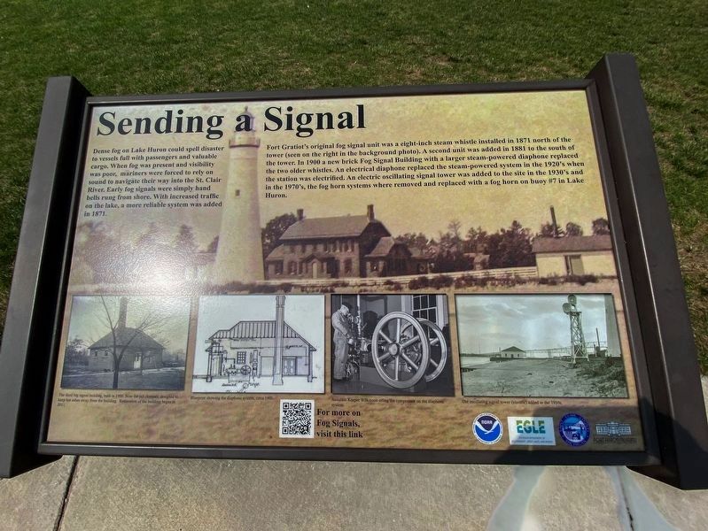
Dense fog on Lake Huron could spell disaster to vessels filled with passengers and valuable cargo. When fog was present and visibility was poor, mariners were forced to rely on sound to navigate their way into the St. Clair River. Early fog signals were simple hand bells rung from shore. With increased traffic on the lake, a more reliable system was added in 1871.
Fort Gratiot's original fog signal was a[n] eight-inch steam whistle installed in 1871 north of the tower (seen on the right in the background photo). A second unit was added in 1881 to the south of the tower. In 1900 a new brick Fog Signal Building with a larger steam-powered diaphone replaced the two older whistles. An electric diaphone replaced the steam-powered system in the 1920's when the station was electrified. An electric oscillating signal tower was added to the site in the 1930's and in the 1970's, the fog horn systems where [sic] removed and replaced with a fog horn on buoy #7 in Lake Huron.
[Bottom photo captions, from left to right, read]
The third fog signal building, built in 1900. Note the tall chimney, designed to keep hot ashes away from the building. Restoration of the building began in 2011.
Blueprint showing the diaphone system, circa 1900.
Assistant Keeper Wilkinson oiling the compressor on the diaphone system.
The oscillating signal tower (electric) added in the 1930s.
Erected by Port Huron Museum, Saint Clair County, Michigan Dept of Environmental Quality, and NOAA.
Topics and series. This historical marker is listed in these topic lists: Communications • Waterways & Vessels. In addition, it is included in the Lighthouses series list. A significant historical year for this entry is 1871.
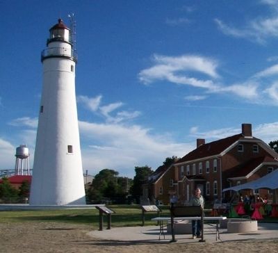
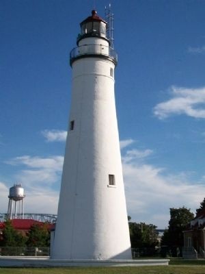
Location. 43° 0.4′ N, 82° 25.347′ W. Marker is in Port Huron, Michigan, in St. Clair County. Marker is about 125 feet north of the lighthouse at Fort Gratiot Light Station County Park, where Lake Huron empties into the St. Clair River. Touch for map. Marker is at or near this postal address: 2800 Omar Street, Port Huron MI 48060, United States of America. Touch for directions.
Other nearby markers. At least 8 other markers are within walking distance of this marker. Seeing the Light (here, next to this marker); The Storm (here, next to this marker); Learning from Lake Huron (here, next to this marker); Keepers Duties (here, next to this marker); Fort Gratiot Light (here, next to this marker); U.S. Coast Guard (about 500 feet away, measured in a direct line); a different marker also named Fort Gratiot Light (about 500 feet away); Great Storm of 1913 and Sailors Memorial (approx. 0.4 miles away). Touch for a list and map of all markers in Port Huron.
Also see . . .
1. Diaphone. Wikipedia website entry (Submitted on July 3, 2023, by Larry Gertner of New York, New York.)
2. Fort Gratiot Lighthouse. Port Huron Museums website entry (Submitted on August 8, 2014, by William Fischer, Jr. of Scranton, Pennsylvania.)
3. Fort Gratiot Light Station: A St. Clair County Park. Park brochure PDF (Submitted on August 8, 2014, by William Fischer, Jr. of Scranton, Pennsylvania.)
4. The Atmosphere in Relation to Fog-Signaling (Popular Science Monthly, March 1875). Wikisource website entry (Submitted on August 8, 2014, by William Fischer, Jr. of Scranton, Pennsylvania.)
Credits. This page was last revised on July 3, 2023. It was originally submitted on August 8, 2014, by William Fischer, Jr. of Scranton, Pennsylvania. This page has been viewed 436 times since then and 18 times this year. Photos: 1. submitted on August 8, 2014, by William Fischer, Jr. of Scranton, Pennsylvania. 2. submitted on August 20, 2022, by J.T. Lambrou of New Boston, Michigan. 3, 4. submitted on August 8, 2014, by William Fischer, Jr. of Scranton, Pennsylvania.


