Santa Fe in Santa Fe County, New Mexico — The American Mountains (Southwest)
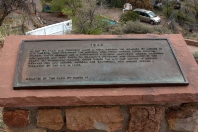
1848
— Commemorative Walkway Park —
Erected 1986 by The Bank of Santa Fe. (Marker Number 10.)
Topics. This historical marker is listed in this topic list: War, Mexican-American. A significant historical month for this entry is May 1848.
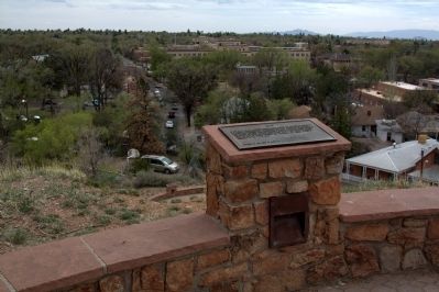
Location. 35° 41.365′ N, 105° 55.994′ W. Marker is in Santa Fe, New Mexico, in Santa Fe County. Marker can be reached from Paseo de Peralta near Otero Street. It is in Hillside Park. Touch for map. Marker is in this post office area: Santa Fe NM 87501, United States of America. Touch for directions.
Other nearby markers. At least 8 other markers are within walking distance of this marker. 1610 (a few steps from this marker); 1926 (a few steps from this marker); 1982 (a few steps from this marker); 1960 (a few steps from this marker); 1985 (a few steps from this marker); 1976 (a few steps from this marker); To the Future (a few steps from this marker); 1945 (a few steps from this marker). Touch for a list and map of all markers in Santa Fe.
Related markers. Click here for a list of markers that are related to this marker. This is a list of all 21 markers on Santa Fe’s Commemorative Walkway at Hillside Park. There is a link on the list to a map of all markers on the walkway.
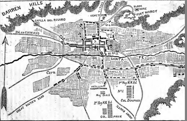
Also see . . . Wikipedia Entry for the Capture of Santa Fe. “On August 9 in Santa Fe, Governor Manuel Armijo wanted to avoid battle, but Catholic priests, Diego Archuleta (the young regular-army commander), and the young militia officers Manuel Chaves and Miguel Pino forced him to muster a defense. Armijo set up a position in Apache Canyon, a narrow pass about 10 miles (16 km) southeast of the city. However, on August 14, before the American army was even in view, he decided not to fight. (An American named James Magoffin claimed he had convinced Armijo and Archuleta to follow this course; an unverified story says he bribed Armijo.) When Pino, Chaves, and some of the militiamen insisted on fighting, Armijo ordered the cannon pointed at them. The New Mexican army retreated to Santa Fe, and Armijo fled to Chihuahua. Kearny and his troops encountered no Mexican forces when they arrived on August 15. Kearny and his force entered Santa Fe and claimed the New Mexico Territory for the United States without a shot being fired.” (Submitted on August 15, 2014.)

Photographed By Allen C. Browne, February 16, 2015
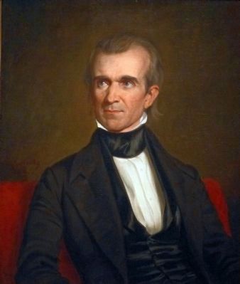
4. James K. Polk
This 1846 portrait of James K. Polk by George P. A. Healy hangs in the National Portrait Gallery in Washington, DC.
“It is often said that James K. Polk was the first ‘dark horse’ to claim a presidential nomination, and during his White House campaign of 1844, his opponents were fond of sneering, ‘Who is James Polk?’ Once he was in office, however, the question quickly lost its sarcastic bite. A diligent worker who abhorred the thought of time unprofitably spent, Polk set four goals for his presidency reducing tariffs, creating an independent treasury system, settling the Oregon boundary dispute with Great Britain, and acquiring California. None of the four objectives was easily reached, and gaining California meant going to war with Mexico. By his administration's close, however, all had been accomplished. Unfortunately, Polk's success came at great personal cost. A spent man., he died within four months of retiring to private life.” — National Portrait Gallery
“It is often said that James K. Polk was the first ‘dark horse’ to claim a presidential nomination, and during his White House campaign of 1844, his opponents were fond of sneering, ‘Who is James Polk?’ Once he was in office, however, the question quickly lost its sarcastic bite. A diligent worker who abhorred the thought of time unprofitably spent, Polk set four goals for his presidency reducing tariffs, creating an independent treasury system, settling the Oregon boundary dispute with Great Britain, and acquiring California. None of the four objectives was easily reached, and gaining California meant going to war with Mexico. By his administration's close, however, all had been accomplished. Unfortunately, Polk's success came at great personal cost. A spent man., he died within four months of retiring to private life.” — National Portrait Gallery
Credits. This page was last revised on June 16, 2016. It was originally submitted on August 15, 2014, by J. J. Prats of Powell, Ohio. This page has been viewed 501 times since then and 14 times this year. Photos: 1, 2, 3. submitted on August 15, 2014, by J. J. Prats of Powell, Ohio. 4. submitted on July 17, 2015, by Allen C. Browne of Silver Spring, Maryland.


