Santa Fe in Santa Fe County, New Mexico — The American Mountains (Southwest)
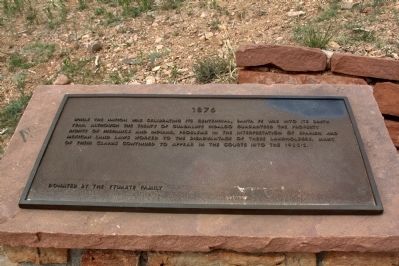
1876
— Commemorative Walkway Park —
Erected 1986 by the Ytuarte Family. (Marker Number 12.)
Topics. This historical marker is listed in this topic list: Government & Politics.
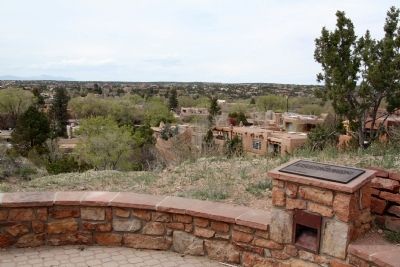
Location. 35° 41.391′ N, 105° 55.986′ W. Marker is in Santa Fe, New Mexico, in Santa Fe County. Marker can be reached from Paseo de Peralta near Otero Street. It is in Hillside Park. Touch for map. Marker is in this post office area: Santa Fe NM 87501, United States of America. Touch for directions.
Other nearby markers. At least 8 other markers are within walking distance of this marker. 1712 (a few steps from this marker); 1776 (within shouting distance of this marker); 1862 (within shouting distance of this marker); 1692 (within shouting distance of this marker); 1912 (within shouting distance of this marker); 1926 (within shouting distance of this marker); 1945 (within shouting distance of this marker); 1960 (within shouting distance of this marker). Touch for a list and map of all markers in Santa Fe.
Related markers. Click here for a list of markers that are related to this marker. This is a list of all 21 markers on Santa Fe’s Commemorative Walkway at Hillside Park. There is a link on the list to a map of all markers on the walkway.
Also see . . . Wikipedia Entry for Spanish land grants in New Mexico. “The Spanish, and later the Mexican, government encouraged settlement of the Territorio de Nuevo Mexico by the establishment of large land grants, many of which were turned into ranchos, devoted to the raising of cattle and sheep. The owners of these ranchos patterned themselves after the landed gentry in Spain. Their workers included Native Americans, some of whom had learned to speak Spanish and ride horses. Of the hundreds of grants, Spain made only a few. The remainder were granted by Mexico after 1821. The ranchos established land-use patterns that are recognizable in the New Mexico of today.
“Land grants were made both to individuals and communities during the Spanish (1598–1821) and Mexican (1821–1846) periods of New Mexico’s history. Nearly all of the Spanish records of land grants that were made in what is now New Mexico prior to the Pueblo Revolt of 1680 were destroyed in the revolt. Thus, historians can often only be certain of land grants that were made after the Spanish Reconquest of New Mexico in 1693. "The two major types of land grants were private grants made to individuals, and communal grants made to groups of individuals for the purpose of establishing settlements. Communal land grants were also made to Pueblos for the lands they inhabited.” (Submitted on August 15, 2014.)
Credits. This page was last revised on June 16, 2016. It was originally submitted on August 15, 2014, by J. J. Prats of Powell, Ohio. This page has been viewed 397 times since then and 14 times this year. Photos: 1, 2, 3. submitted on August 15, 2014, by J. J. Prats of Powell, Ohio.


