Eagle Harbor in Keweenaw County, Michigan — The American Midwest (Great Lakes)
Eagle Harbor
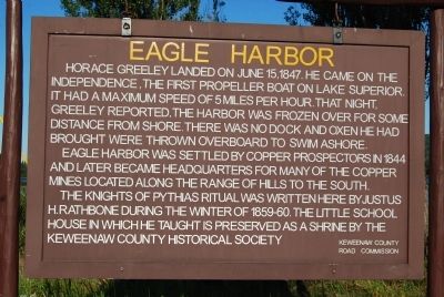
Eagle Harbor was settled by copper prospectors in 1844 and later became headquarters for many of the copper mines located along the range of hills to the south.
The Knights of Pythias ritual was written here by Justus H. Rathbone during the winter of 1859-60. The little school house in which he taught is preserved as a shrine by the Keweenaw County Historical Society.
Erected by Keweenaw County Road Commission.
Topics. This historical marker is listed in these topic lists: Education • Settlements & Settlers. A significant historical month for this entry is June 1845.
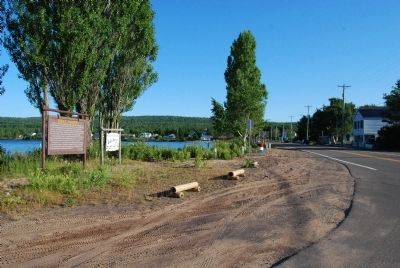
Location. 47° 27.488′ N, 88° 9.653′ W. Marker is in Eagle Harbor, Michigan, in Keweenaw County. Marker is at the intersection of State Highway 26 and North Street, on the right when traveling north on State Highway 26. Touch for map. Marker is in this post office area: Mohawk MI 49950, United States of America. Touch for directions.
Other nearby markers. At least 8 other markers are within walking distance of this marker. The Eagle Harbor General Store (within shouting distance of this marker); Eagle Harbor House (about 500 feet away, measured in a direct line); Iron-Stock Anchor (about 500 feet away); Riveted Bell Buoy (about 500 feet away); Wood-Stock Anchor (about 500 feet away); Eagle Harbor Lighthouse and Museums (about 600 feet away); Fog Signal Building (about 700 feet away); Michigan DNR Marina (about 700 feet away). Touch for a list and map of all markers in Eagle Harbor.
Also see . . . Exploring Eagle Harbor and Eagle River in the Upper Peninsula of Michigan. (Submitted on August 16, 2014, by Mike Wintermantel of Pittsburgh, Pennsylvania.)
Credits. This page was last revised on June 16, 2016. It was originally submitted on August 16, 2014, by Mike Wintermantel of Pittsburgh, Pennsylvania. This page has been viewed 500 times since then and 17 times this year. Photos: 1, 2. submitted on August 16, 2014, by Mike Wintermantel of Pittsburgh, Pennsylvania.

