Lawrence Cultural District in Douglas County, Kansas — The American Midwest (Upper Plains)
John Brown and the Siege of Lawrence, September 14-15, 1856
Inscription.
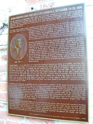
On the afternoon of September 14th, 1856, the Free State settlement of Lawrence, Kansas Territory was threatened with invasion by an army of 2700 Pro-slavery Missourians under the command of Generals David R. Atchison and John W. Reid. Encamping near Franklin, four miles southeast of Lawrence, the Missourians were determined to wipe out the town that stood as a symbol of New England abolitionism.
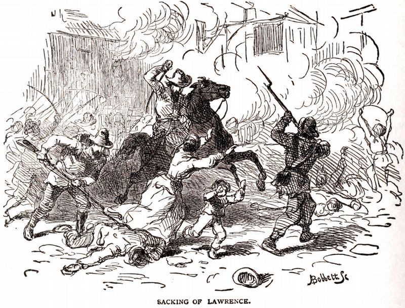
Less than four months earlier, Atchison and Sheriff Jones led the Sack of Lawrence, destroying the Free State Hotel and the Herald of Freedom presses. In the ensuing months, Lawrence was blockaded, and by mid-August, battles were fought in Douglas County at Fort Franklin, Fort Saunders and Fort Titus in an attempt to loosen the stranglehold on supply lines into the half-starved Free State fortress. Now the townspeople, armed with everything from Sharps rifles to pitchforks, converged between two circular earthen forts on Massachusetts Street and prepared to defend their town.
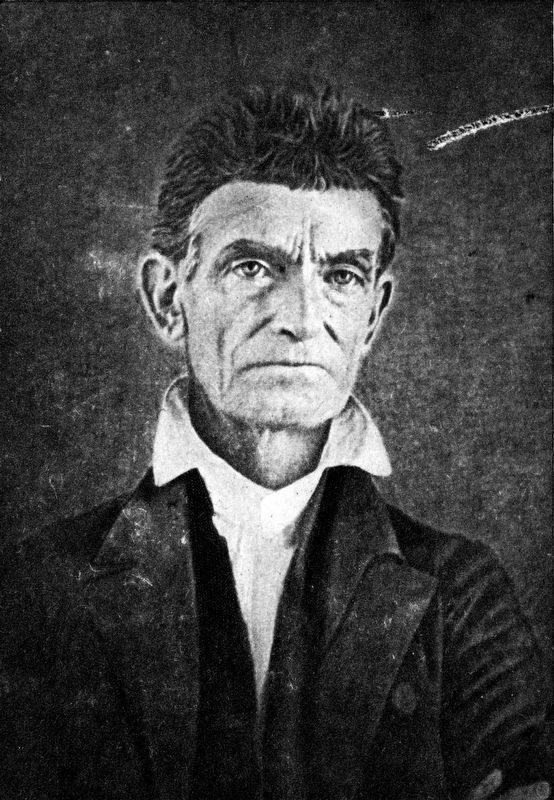
Present and heavily armed that afternoon was John Brown, the fiery New York abolitionist and Captain of the Liberty Guards in Lawrence during the Wakarusa War of early December, 1855. Brown, along with his sons, had spent much of the spring and summer of 1856 engaged in brutal guerrilla warfare against Pro-slavery factions throughout eastern Kansas. Though he had no formal command during the siege, Brown did give an address on tactics to an estimated 300 armed Lawrence citizens as he stood on a dry goods box twenty-fire feet west of this plaque. Richard J. Hinton, a correspondent for the Boston Traveller, took down a portion of the address made by Brown, by then a hardened veteran of numerous gun battles with the Pro-slavery forces:
“GENTLEMEN, -- It is said there are twenty-five hundred Missourians down at Franklin, and that they will be here in two hours. You can see for yourselves the smoke they are making by setting fire to the houses in that town. Now is probably the last opportunity you will have of seeing a fight, so that you had better do your best. If they should come up and attack us, don’t yell and make a great noise, but remain perfectly silent and still. Wait till they get within twenty-five yards of you; get a good object; be sure you see the hind sight of your gun, then fire. A great deal of powder and lead and very precious time is wasted by shooting too high. You had better aim at their legs than at their heads. In either case, be sure of the hind sights of your guns. It is from neglect of this that I myself have so many times escaped; for if all the bullets that have ever been aimed at me had hit, I should have been as full of holes as a riddle.”
Following an exchange of gunfire
on the southeastern outskirts of the town between an advance guard of the Missouri forces and the Lawrence defenders, the Missourians were driven back to Franklin. The arrival late in the evening of 300 U.S. Army dragoons from Lecompton, who took up positions with full artillery across the brow of Mount Oread, created a standoff. When Governor John W. Geary and Lieutenant-Colonel Philip St. George Cooke arrived early on the morning of the 15th, heated negotiations led to the Missourians reluctantly disbanding and fully retreating. This brought to a close the open warfare that existed during this bloodiest year of the Bleeding Kansas period, with over 200 left dead. Many of the Missourians would return, however, August 21st, 1863 with William C. Quantrill as their leader.
Fearing that Governor Geary might act on a warrant for his arrest, John Brown left Lawrence heading for Osawatomie, which two weeks earlier was destroyed by the same forces arrayed against Lawrence. Brown continued to visit Lawrence, off and on, until January of 1859. He was hanged December 2nd, 1859 at Charlestown, Virginia, following his raid on the Federal arsenal at Harpers Ferry, becoming a hero to millions of African-Americans enslaved throughout the South, and igniting the fuse that eventually led to the American Civil War.
Text compiled for the Free State Brewing Company by Karl Gridley, 1998
Erected by Free State Brewing Company.
Topics. This historical marker is listed in these topic lists: Abolition & Underground RR • Settlements & Settlers. A significant historical year for this entry is 1856.
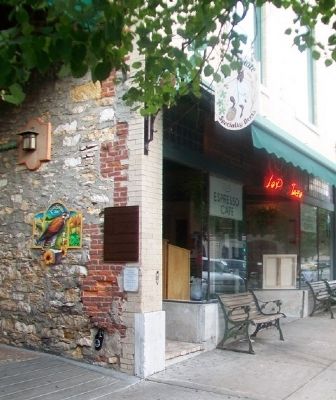
Location. 38° 58.303′ N, 95° 14.143′ W. Marker is in Lawrence, Kansas, in Douglas County. It is in the Lawrence Cultural District. Marker is on Massachusetts Street south of 6th Street, on the left when traveling south. Touch for map. Marker is at or near this postal address: 636 Massachusetts Street, Lawrence KS 66044, United States of America. Touch for directions.
Other nearby markers. At least 8 other markers are within walking distance of this marker. Liberty Hall (within shouting distance of this marker); 700-702 Massachusetts Street (within shouting distance of this marker); The First Lawrence U.S. Post Office (within shouting distance of this marker); Free State Hotel (about 300 feet away, measured in a direct line); Anderson Building (about 400 feet away); Miller's Hall (about 500 feet away); Lawrence Studio (about 600 feet away); House Building (about 600 feet away). Touch for a list and map of all markers in Lawrence.
Also see . . .
1. The Sack of Lawrence, [May 21] 1856. Etewitness to History website entry (Submitted on August 16, 2014, by William Fischer, Jr. of Scranton, Pennsylvania.)
2. Lawrence, Kansas. Civil War on the Western Border website entry (Submitted on August 16, 2014, by William Fischer, Jr. of Scranton, Pennsylvania.)
3. John Brown (abolitionist). Wikipedia entry (Submitted on December 13, 2021, by Larry Gertner of New York, New York.)
4. Border Disputes and Warfare. Territorial Kansas Online website entry (Submitted on August 16, 2014, by William Fischer, Jr. of Scranton, Pennsylvania.)
Credits. This page was last revised on February 10, 2023. It was originally submitted on August 16, 2014, by William Fischer, Jr. of Scranton, Pennsylvania. This page has been viewed 1,081 times since then and 56 times this year. Photos: 1, 2. submitted on August 16, 2014, by William Fischer, Jr. of Scranton, Pennsylvania. 3, 4. submitted on June 22, 2018, by Allen C. Browne of Silver Spring, Maryland.


