Santa Fe in Santa Fe County, New Mexico — The American Mountains (Southwest)
The Founding of Santa Fe
Don Pedro De Peralta
— 1610 —
(right tablet)
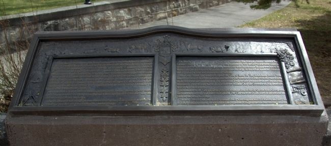
On March 30, 1609, the Viceroy of New Spain appointed Don Pedro de Peralta Governor and Captain-General of New Mexico, instructing him to proceed to New Mexico with the greatest dispatch accompanied by twelve soldiers and priests. Instructions were that en-route Indians were not to be harmed and just prices were to be paid for all sustenance and help. He was to take horses and livestock and a quantity of tools and implements for farming.
Above all, Peralta was ordered to found the Villa of Santa Fe. The inhabitants thereof were empowered to elect their own aldermen and mayors, who were to try civil and criminal cases arising in the town and surrounding area. The town council was to elect a constable and scribe, and pass ordinances. These officials had no jurisdiction over Indians. Only the Governor and his lieutenancy were to have such powers.
Each resident of the Villa was allotted lots for a house, garden, orchards, vineyards and olive groves, and four tracts for crops with water for irrigation. The Villa was to be divided into six districts and one plaza for the Royal buildings.
The new Governor was instructed to consult closely with religious and civil leaders, and carry out policies by common consent. He was admonished to proceed with great care and mature consideration.
(left tablet)
El 30 de Marzo de 1609 el Virrey de la Nueva España nombró a Don Pedro de Peralta Gobernador y Capitán General del Nuevo México, ordenándole que debería salir para Nuevo México con la mayor brevedad con doce soldados y religiosos. Fué ordenado que en ruta no se causarían inquietudes ní daños a los Indios y que se pagaría justo precio por el sustento y ayuda que le diesen. Debería de llevar consigo caballos y boyada y una cantidad de herramientas y demás apero necesario para las labranzas.
Antes de todo se le ordenó que fundase la Villa de Santa Fé. Los habitantes de esa Villa tendrían el derecho de elegir sus regidores y alcaldes, quienes juzgarían los casos criminales y civiles que ocurriesen en la Villa y cercanías. El cabildo podría elegir un aguacil y un escríbano y hacer ordenanzas. Estos oficiales no podrían tener jurisdicción sobre los Indios. Sólo el Gobernador y su lugarteniente tendrían dicha jurisdicción.
A cada vecino de
la Villa se le señalaría solares para casa, jardín, huertas, viñedos, olivares y cuatro caballerías para sembrar con el agua para su riego. La Villa se dividiría en seis distritos y una plaza donde se construirían las Casas Reales.
El nuevo gobernador se le encargó que consultarse con los religiosos y civiles en común acuerdo. Fué advertido que procediese con gran consideración y maduro consejo.
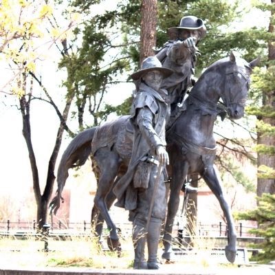
Erected 1992 by the City of Santa Fe 1% For Art in Public Places.
Topics. This historical marker is listed in these topic lists: Colonial Era • Settlements & Settlers. A significant historical month for this entry is March 1958.
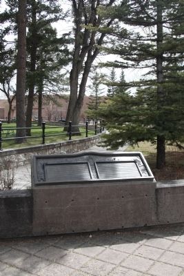
Location. 35° 41.508′ N, 105° 56.365′ W. Marker is in Santa Fe, New Mexico, in Santa Fe County. Marker is on North Federal Place near Paseo De Peralta and Grant Avenue, on the right when traveling north. North Federal Place is just the right turn lane for Grant Avenue turning into eastbound Paseo De Peralta. There is no street sign for it but it is on all the online maps. The sign to look out for is the sign for “City of Santa Fe Don Pedro de Peralta Park.”. Touch for map. Marker is in this post office area: Santa Fe NM 87501, United States of America. Touch for directions.
Other nearby markers. At least 8 other markers are within walking distance of this marker. The Courtyard of Catua and Omtua (about 700 feet away, measured in a direct line); Staff Sergeant Leroy A. Petry (approx. 0.2 miles away); The Old Spanish Trail (approx. 0.2 miles away); Hewett House (approx. ¼ mile away); Officer's Quarters (approx. ¼ mile away); Cross of the Martyrs (approx. ¼ mile away); Museum of Fine Arts (approx. ¼ mile away); Richard P. "Dickie" Montoya (approx. ¼ mile away). Touch for a list and map of all markers in Santa Fe.
Photographed By J. J. Prats, April 18, 2014
5. “The Founding of Santa Fe” Additional Tablets
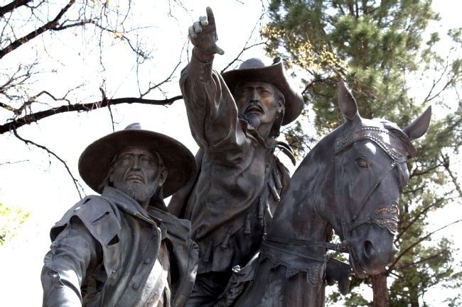
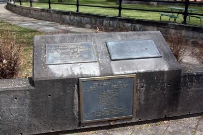
The tablet on the left reads, “The City of Santa Fe 1% for Art in Public Places. ‘The Founding of Santa Fe’ by Dave McGary. Dedicated to the Citizens of Santa Fe September 12, 1992.” The tablet on the right is in braille. The lower tablet reads, “Peralta Park. Major: Sam Pick; City Manager: Isaac J. Pino; City Council: Peso Chavez, Larry A. Delgado, Steven G. Farber, Phil Griego, Debbie Jaramillo, Ouida MacGregor, Frank Montano, Art Sanchez. CIP Project #435, CIP Director: John C. Griego, Landscape Architect: Morrow & Co., Contractor: Heads Up Inc. Completed: September 1992.”
Credits. This page was last revised on June 16, 2016. It was originally submitted on August 17, 2014, by J. J. Prats of Powell, Ohio. This page has been viewed 770 times since then and 35 times this year. Photos: 1, 2, 3, 4, 5. submitted on August 17, 2014, by J. J. Prats of Powell, Ohio.
