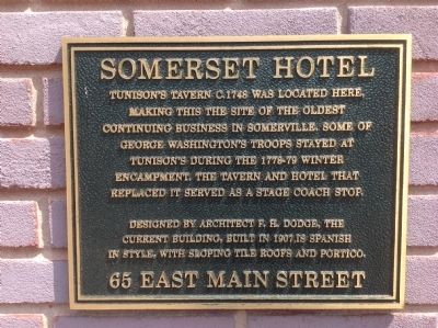
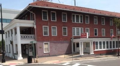
Somerset Hotel
Designed by architect F.H. Dodge, the current building, built in 1907, is Spanish in style, with sloping tile roofs and portico.
Topics. This historical marker is listed in these topic lists: Colonial Era • Industry & Commerce. A significant historical year for this entry is 1748.
Location. 40° 34.061′ N, 74° 36.594′ W. Marker is in Somerville, New Jersey, in Somerset County. Marker is at the intersection of East Main Street and Grove Street on East Main Street. Touch for map. Marker is at or near this postal address: 65 East Main Street, Somerville NJ 08876, United States of America. Touch for directions.
Other nearby markers. At least 8 other markers are within walking distance of this marker. Washington’s Route from Princeton to Morristown (a few steps from this marker); Fourth New Jersey Infantry Appreciation to Somerville (within shouting distance of this marker); National Guard Armory (about 300 feet away, measured in a direct line); Somerset County Court House Green (about 300 feet away); Somerset County 9/11 Memorial and Clock Tower (about 500 feet
Credits. This page was last revised on June 16, 2016. It was originally submitted on August 19, 2014, by Somerset County Library Staff of Bridgewater, New Jersey. This page has been viewed 1,515 times since then and 216 times this year. Photos: 1, 2. submitted on August 19, 2014, by Somerset County Library Staff of Bridgewater, New Jersey. • Bill Pfingsten was the editor who published this page.

