A Bit of History
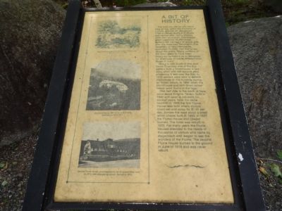
The land you see as you stand here all lies within the township of Lincoln, granted on January 31, 1764 to James Avery and others and named after Henry Clinton, ninth Earl of Lincoln. The original grant contained 32,456 acres. Settlers did not begin to arrive until after the American Revolution. The Gazetteer of New Hampshire published in 1856 had this to say about the grant. "Many portions of the town seem to have been designed by Nature as a residence for creatures of habits different from those of men."
About a mile south of this spot David Guernsey one of the first settlers built a blockhouse, a two story affair with the second story projecting 8 feet over the first. In 1812 settlers were able to defend themselves in this building during an Indian attack. In 1892 when the blockhouse was torn down arrowheads were found in the logs.
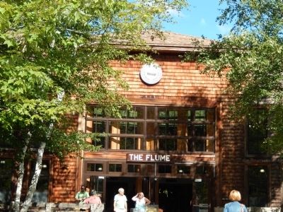
One half mile to the north of here once stood Knights Tavern, built in 1846 and open to travelers for several years. Near the same location in 1848 the first Flume House was built where visitors could eat and sleep for $1.50 per day. Across the road stood a small white chapel built in 1853. In 1871 the Flume House and Chapel burned. The hotel was rebuilt in 1872. For many years the Flume Houses attended to the needs of thousands of visitors who came by stagecoach and wagon to see the wonders
of the Flume. The second Flume House burned to the ground in June of 1918 and was never rebuilt.Topics. This historical marker is listed in these topic lists: Colonial Era • Entertainment • Industry & Commerce • War of 1812. A significant historical month for this entry is January 2035.
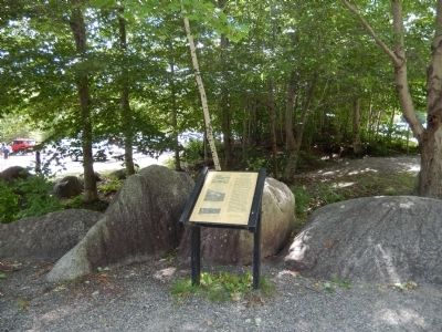
Location. 44° 5.827′ N, 71° 40.844′ W. Marker is in Franconia, New Hampshire, in Grafton County. Marker is on U.S. 3. Marker is in Franconia Notch State Park. Touch for map. Marker is in this post office area: Franconia NH 03580, United States of America. Touch for directions.
Other nearby markers. At least 8 other markers are within 4 miles of this marker, measured as the crow flies. Franconia Notch State Park (a few steps from this marker); Eastern Brook Trout (a few steps from this marker); The Flume (within shouting distance of this marker); Franconia Range (within shouting distance of this marker); a different marker also named The Flume (about 400 feet away, measured in a direct line); Betty and Barney Hill Incident (approx. 0.8 miles away); Clark's Bridge (approx. 3.2 miles away); Quinten E. Mulleavey (approx. 3.2 miles away). Touch for a list and map of all markers in Franconia.
Credits. This page was last revised on June 16, 2016. It was originally submitted on August 21, 2014, by Bill Pfingsten of Bel Air, Maryland. This page has been viewed 484 times since then and 32 times this year. Photos: 1, 2, 3. submitted on August 21, 2014, by Bill Pfingsten of Bel Air, Maryland.


