Near Point of Rocks in Frederick County, Maryland — The American Northeast (Mid-Atlantic)
Battle at Point of Rocks
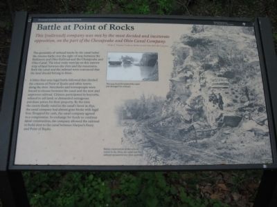
This [railroad] company was met by the most decided and inveterate opposition, on the part of the Chesapeake and Ohio Canal Company.
Philip E. Thomas, President, Baltimore and Ohio Railroad Company
The proximity of railroad tracks by the canal belies the intense battle over the right-of-way between the Baltimore and Ohio Railroad and the Chesapeake and Ohio Canal. The idea route west lay on this narrow strip of land between the river and the mountains. Both the canal and the railroad were convinced that the land should belong to them.
A bitter four-year battle followed that divided the citizens of Point of Rocks and other towns along the river. Merchants and townspeople were forced to choose between the canal and the new and unproven railroad. Citizens participated in boycotts, refused to sell land, or demanded outrageous purchase prices for their property. By the time the courts finally ruled in the canal's favor in 1832, the canal company had almost gone broke with legal fees. Strapped for cash, the canal company agreed to a compromise. In exchange for funds to continue canal construction, the company allowed the railroad to build next to the canal between Harper's Ferry and Point of Rocks.
Erected by Chesapeake and Ohio Canal National Historic Park - National Park Service - Department of the Interior.
Topics and series. This historical marker is listed in these topic lists: Railroads & Streetcars • Waterways & Vessels. In addition, it is included in the Baltimore and Ohio Railroad (B&O), and the Chesapeake and Ohio (C&O) Canal series lists. A significant historical year for this entry is 1832.
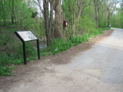
Location. 39° 16.424′ N, 77° 32.601′ W. Marker is near Point of Rocks, Maryland, in Frederick County. Marker is on Canal Street, on the right when traveling west. Located along the towpath for the Chesapeake and Ohio Canal, just to the east of the Highway 15 bridge. Touch for map. Marker is in this post office area: Point of Rocks MD 21777, United States of America. Touch for directions.
Other nearby markers. At least 8 other markers are within walking distance of this marker. Point of Rocks (about 800 feet away, measured in a direct line); a different marker also named Point of Rocks (approx. 0.2 miles away); a different marker also named Point of Rocks (approx. 0.2 miles away); a different marker also named Point of Rocks (approx. 0.2 miles away); a different marker also named Point of Rocks (approx. 0.2 miles away); a different marker also named Point of Rocks (approx. ¼ mile away); a different marker also named Point of Rocks (approx. ¼ mile away); Loudoun County / Maryland (approx. 0.3 miles away in Virginia). Touch for a list and map of all markers in Point of Rocks.
More about this marker. On the right a photograph shows the railroad and canal running beside the cliffs at Point of Rocks. It is captioned, Before construction of the railroad tunnel in the 1860s, the canal and the railroad operated in very close quarters. An inset photo shows The 1924 flood devastated the canal and damaged the railroad. In the photograph the water is within the railroad tunnel.
Also see . . .
1. Chesapeake and Ohio Canal. National Park Service site. (Submitted on May 7, 2008, by Craig Swain of Leesburg, Virginia.)
2. The Catoctin Formation. The Catoctin Range was the geological factor in the dispute. Because this line of mountains spans across the Potomac at Point of Rocks, it forms a natural barrier. (Submitted on May 7, 2008, by Craig Swain of Leesburg, Virginia.)
3. Impossible Challenge: The Baltimore and Ohio (B&O) Railroad in Maryland. (Submitted on October 14, 2008, by Tom Fuchs of Greenbelt, Maryland.)
4. Impossible Challenge II: Baltimore to Washington and Harpers Ferry 1828 to 1994. (Submitted on October 14, 2008, by Tom Fuchs of Greenbelt, Maryland.)
5. The Met A History of the Metropolitan Branch of the B&O Railroad, Its Stations and Towns. (Submitted on October 15, 2008, by Tom Fuchs of Greenbelt, Maryland.)
6. Baltimore and Ohio Railroad (Railroad Color History). (Submitted on October 15, 2008, by Tom Fuchs of Greenbelt, Maryland.)
7. Baltimore and Ohio Railroad (MBI Railroad Color History). (Submitted on October 15, 2008, by Tom Fuchs of Greenbelt, Maryland.)
8. Chessie System (MBI Railroad Color History). (Submitted on October 15, 2008, by Tom Fuchs of Greenbelt, Maryland.)
9. CSX (MBI Railroad Color History). (Submitted on October 15, 2008, by Tom Fuchs of Greenbelt, Maryland.)
10. Baltimore and Ohio Railroad in the Potomac Valley (Golden Years of Railroading). (Submitted on October 15, 2008, by Tom Fuchs of Greenbelt, Maryland.)
11. Baltimore and Ohio in the Civil War. (Submitted on October 15, 2008, by Tom Fuchs of Greenbelt, Maryland.)
12. Baltimore and Ohio's Capitol Limited and National Limited (Great Passenger Trains). (Submitted on October 15, 2008, by Tom Fuchs of Greenbelt, Maryland.)
13. Route of the National Limited (Baltimore and Ohio Passenger Service 1945 - 1971 Volume 1). (Submitted on October 15, 2008, by Tom Fuchs of Greenbelt, Maryland.)
14. Route of the Capitol Limited (Baltimore and Ohio Passenger Service 1945 - 1971 Volume 2)
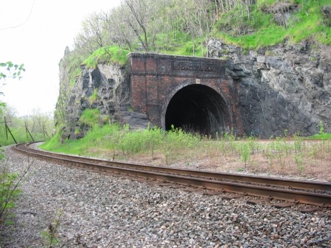
Photographed By Craig Swain, April 19, 2008
3. Railroad Tunnel and Railroad Bed
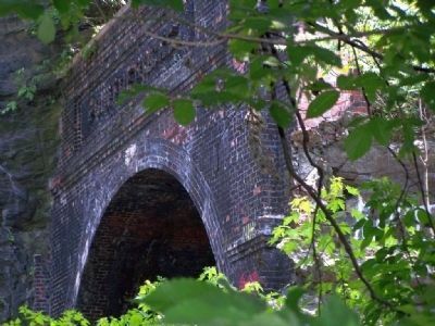
This point of view is similar to the photograph provided on the right side of the marker. However, after that photo was taken, the railroad constructed a tunnel through the mountain. The old railroad bed is still in use running parallel to the tunnel.
15. The Great Road. Building of the Baltimore and Ohio, the Nation's First Railroad 1828 - 1853. (Submitted on October 15, 2008, by Tom Fuchs of Greenbelt, Maryland.)
Credits. This page was last revised on February 25, 2022. It was originally submitted on May 7, 2008, by Craig Swain of Leesburg, Virginia. This page has been viewed 2,824 times since then and 42 times this year. Photos: 1, 2, 3. submitted on May 7, 2008, by Craig Swain of Leesburg, Virginia. 4. submitted on May 7, 2008, by Mike Stroud of Bluffton, South Carolina. 5. submitted on May 7, 2008, by Craig Swain of Leesburg, Virginia.
