Urbana in Frederick County, Maryland — The American Northeast (Mid-Atlantic)
Urbana
Capture and Escape
— Early's 1864 Attack on Washington —
(preface)
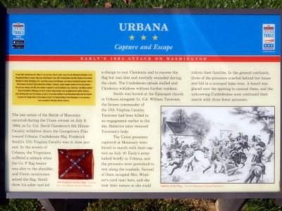
In June 1864, Confederate Gen. Robert E. Lee and Gen. Jubal A. Early’s corps from the Richmond battlefields to the Shenandoah Valley to counter Union Gen. David Hunter’s army. After driving Hunter into West Virginia, Early invaded Maryland to attack Washington D.C., draw Union troops from Richmond, and release Confederate prisoners held at Point Lookout. On July 9, Early ordered Gen. Bradley T. Johnson’s cavalry brigade eastward to free the prisoners. The next day, Johnson sent Maj. Harry Gilmer’s regiment to raid the Baltimore area. Union Gen. Lew Wallace delayed Early at the Battle of Monocacy on Jul 9. Federal reinforcements soon strengthened the capital’s defenses. Early attacked there near Fort Stevens on July 11-12 and then withdrew to the Shenandoah Valley with the Federals in pursuit. He stopped them at Cool Spring on July 17-18. Despite failing to take Washington or free prisoners, Early succeeded in diverting Federal resources.
(main text)
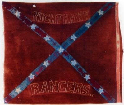
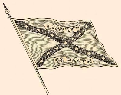
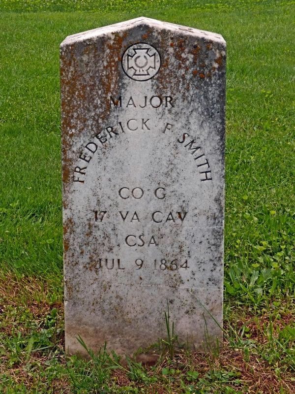
The last action of the Battle of Monocacy occurred during the Union retreat on July 9, 1864, as Lt. Col. David Clendenin's 8th Illinois Cavalry withdrew down the Georgetown Pike toward Urbana. Confederate Maj. Frederick Smith's 27th Virginia Cavalry was in close pursuit. In the Streets of Urbana, the Virginians suffered a setback when the Co. F flag bearer was shot in the shoulder, and Union cavalrymen seized the flag. Smith drew his saber and led a charge to rout Clendenin and to recover the flag but was shot and mortally wounded during the clash. The Confederate attack stalled and Clendenin withdrew without further incident.
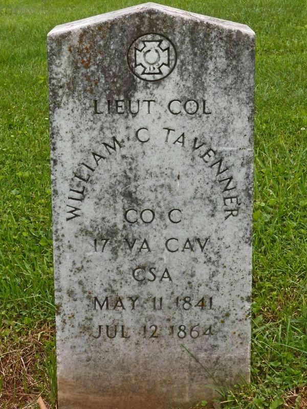
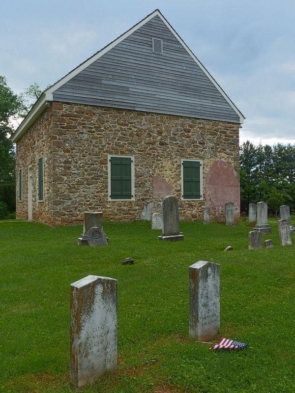
Smith was buried at the Episcopal church in Urbana alongside Lt. Col. William Tavenner, the former commander of the 17th Virginia Cavalry. Tavenner had been killed in an engagement earlier in the day. Relatives later removed Tavenner's body.
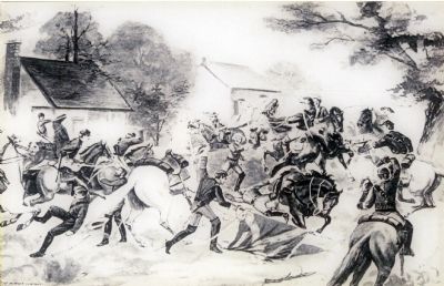
The Union prisoners captured at Monocacy were forced to march with their captors on July 10. Early's army halted briefly in Urbana, and the prisoners were permitted to rest along the roadside. Several of them occupied Mrs. Windsor's yard near here, and she took their names so she could inform their families. In the general confusion, three of the prisoners crawled behind her house and hid in a cramped bake oven. A board was placed over the opening to conceal them, and the unknowing Confederates soon continued their march with three fewer prisoners.
Erected by Maryland Civil War Trails.
Topics and series. This historical marker is listed in this topic list: War, US Civil. In addition, it is included in the Maryland Civil War Trails series list. A significant historical month for this entry is June 1864.
Location. 39° 19.723′ N, 77° 21.659′ W. Marker is in Urbana, Maryland, in Frederick County. Marker can be reached from the intersection of Urban Pike and Lew Wallace Street, on the left when traveling west. Marker is in Urbana Community Park. Touch for map. Marker is at or near this postal address: 3636 Urban Pike, Frederick MD 21704, United States of America. Touch for directions.
Other nearby markers. At least 8 other markers are within 3 miles of this marker, measured as the crow flies. War on Terrorism Memorial (approx. 0.6 miles away); Amelung Glass Works (approx. one mile away); Dennis Memorial (approx. 1.3 miles away); George Washington (approx. 1.6 miles away); Clustered Spires of Frederick (approx. 2.1 miles away); The Battle That Saved Washington (approx. 2.1 miles away); History of the Monocacy River Valley (approx. 2.1 miles away); Civilians Under Siege (approx. 2½ miles away). Touch for a list and map of all markers in Urbana.
Also see . . . The Story of the Flag,. Internet Archive website entry:
1896, Lew Wallace explains the battle of Monocacy and tells how he came to own the flag of the Nighthawk Rangers. (Submitted on October 31, 2014, by Allen C. Browne of Silver Spring, Maryland.)
Credits. This page was last revised on March 23, 2022. It was originally submitted on August 29, 2014, by Allen C. Browne of Silver Spring, Maryland. This page has been viewed 1,328 times since then and 70 times this year. Photos: 1, 2, 3, 4. submitted on August 29, 2014, by Allen C. Browne of Silver Spring, Maryland. 5. submitted on October 31, 2014, by Allen C. Browne of Silver Spring, Maryland. 6, 7, 8. submitted on May 26, 2017, by Allen C. Browne of Silver Spring, Maryland. • Bernard Fisher was the editor who published this page.
