Rodanthe in Dare County, North Carolina — The American South (South Atlantic)
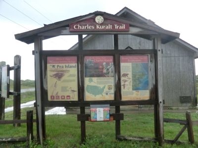
Charles Kuralt Trail
Pea Island National Wildlife Refuge
Panel 1
Welcome & Enjoy
Your National Wildlife Refuge
Pea Island
Established in 1938, Pea Island NWR included over 5,800 acres of typical barrier island habitat that has been carefully managed to better provide for the needs of wildlife.
The Refuge plays an important role as a nesting, wintering, and nesting area for many migratory birds, and lies on the northern edge of the nesting range for loggerhead, interpretive and educational programs, and fishing on Pea Island.
From this site, you may enjoy the Refuge Visitor Center, observe wildlife from the North Pond Wildlife Trail, or walk across the dunes to explore the ocean and beach. Birding is especially good during the fall and winter, and fall is the best time for surf fishing. Guided walks and tours are offered in summer and fall.
Panel 2
On the Refuge Road
Charles Kuralt
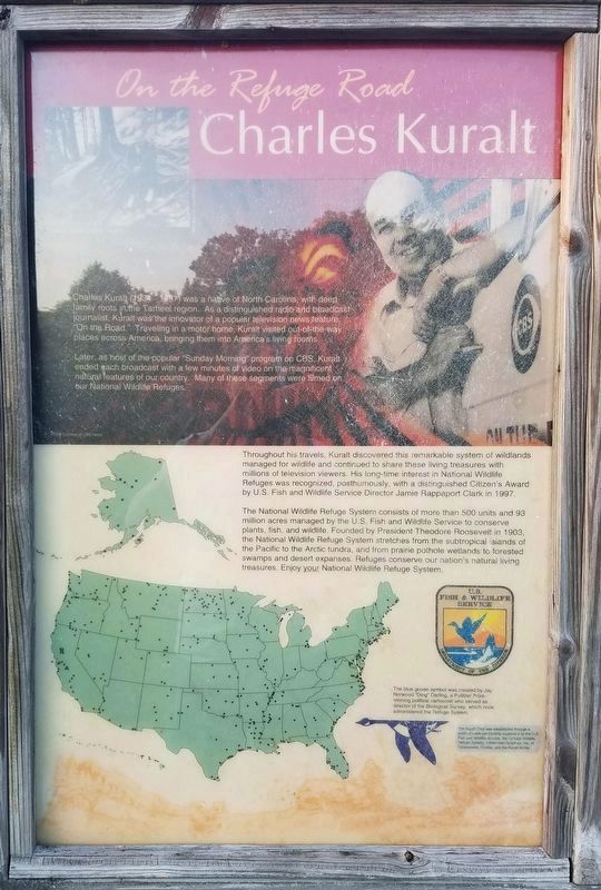
Charles Kuralt (1934-1997) was a native of North Carolina, with deep family roots in the Tarheel region. As a distinguished radio and broadcast journalist, Kuralt was the innovator of a popular television news feature, “On the Road”. Traveling in a motor home, Kuralt, visited out-of-the-way places across America, bringing them into America’s living rooms. Later as host of the popular “Sunday Morning” program on CBS, Kuralt, ended each broadcast with a few minutes of video on the magnificent natural features of our country. Many of these segments were filmed on our National Wildlife Refuges.
Throughout his travels, Kuralt discovered this remarkable system of wildlands managed for wildlife and continued to share these living treasures with millions of television viewers. His long-time interest in National Wildlife Refuges was recognized, posthumously, with a distinguished Citizen’s Award by U.S. Fish and Wildlife Service Director Jamie Rappaport Clark in 1997.
The National Wildlife Refuge System consists of more than 500 units and 93 million acres managed by the U.S. Fish and Wildlife Service to conserve plants, fish, and wildlife. Founded by President Theodore Roosevelt in 1903, the National Wildlife Refuge System stretches from the subtropical islands of the Pacific to the Arctic tundra and from prairie pothole wetlands to forested swamps and desert expanses. Refuges conserve our nation’s natural living treasurers. Enjoy your National Wildlife Refuge System.
Panel 3
Roanoke • Tar • Neuse • Cape Fear
Ecosystem
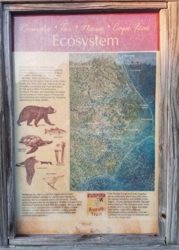
Stretching from the foothills of the Appalachians to the coastal plain of North Carolina, the Outer Banks region is laced with rivers-Roanoke, Tar, Neuse, and Cape Fear. Flowing into the lagoons contained by the barrier islands of the Outer Banks, the rivers and sea meet to create an incredibly productive and important place for fish and wildlife. The Albemarle, Currituck, Pamlico, and Back Bay estuaries are nurseries for many types of marine life and a feeding and resting area for migratory waterfowl and other wildlife.
Wildlands are still found in this region and contain important habitat needed by resident and migratory species, and endangered plants and animals. These areas are protected by the National Wildlife Refuges in the Roanoke/Tar/Neuse/Cape Fear Ecosystem. Refuges also provide many opportunities for people to enjoy wildlife-oriented outdoor recreation-fishing, hunting, wildlife observation, nature photography, interpretation, and environmental education.
The Charles Kuralt Trail links together some particularly good sites that show the special character and wildlife of the region. Eleven National Wildlife Refuge and a National Fish Hatchery each have a wildlife site for you to enjoy and begin your further exploration of these remarkable wildlife treasurers. You can purchase an audio tape to enhance your trip on the refuge road.
Erected by Fish & Wildlife Service, U.S. Department of the Interior.
Topics and series. This historical marker is listed in these topic lists: Animals • Environment. In addition, it is included in the Former U.S. Presidents: #26 Theodore Roosevelt series list. A significant historical year for this entry is 1938.
Location. 35° 42.957′ N, 75° 29.601′ W. Marker is in Rodanthe, North Carolina, in Dare County. Marker is on State Highway 12, 4 miles south of Lifeboat Station Road, on the left when traveling south. The marker is located on the grounds of the Pea Island National Wildlife Refuge Visitor Center. Touch for map. Marker is in this post office area: Rodanthe NC 27968, United States of America. Touch for directions.
Other nearby markers. At least 8 other markers are within 9 miles of this marker, measured as the crow flies. Fish & Wildlife Service (within shouting distance of this marker); Gulls and Terns (about 300 feet away, measured in a direct line); Pea Island Lifesavers (about 500 feet away); Giant Bluefin Tuna (approx. 6.4 miles away); Mirlo Rescue (approx. 8 miles away); Bodie Island Lighthouse (approx. 8.1 miles away); All for Safe Passage (approx. 8.1 miles away); Bodie Island Light Station (approx. 8.2 miles away). Touch for a list and map of all markers in Rodanthe.
Also see . . .
1. Pea Island National Wildlife Refuge. U.S. Fish & Wildlife Service (Submitted on September 4, 2014.)
2. Pea Island National Wildlife Refuge. OuterBanks.com (Submitted on September 4, 2014.)
3. Pea Island National Wildlife Refuge. Wikipedia (Submitted on September 4, 2014.)
Credits. This page was last revised on August 1, 2020. It was originally submitted on September 1, 2014, by Don Morfe of Baltimore, Maryland. This page has been viewed 597 times since then and 33 times this year. Photos: 1, 2. submitted on December 7, 2019, by Kevin W. of Stafford, Virginia. 3, 4. submitted on September 1, 2014, by Don Morfe of Baltimore, Maryland. • Bernard Fisher was the editor who published this page.


