Lockport in Niagara County, New York — The American Northeast (Mid-Atlantic)
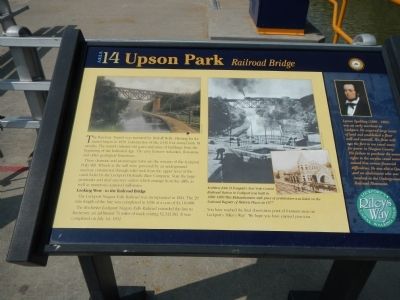
Upson Park
These dramatic and picturesque ruins are the remains of the Lockport Pulp Mill. Wheels at the mill were powered by an underground raceway constructed through solid rock from the upper level of the canal locks s by the Lockport Hydraulic Race Company. Note the large penstock and dual raceway outlets which emerge from the cliffs, as well as numerous scattered millstones.
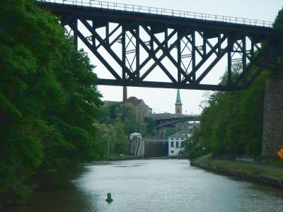
Looking West - to the Railroad Bridge
The Lockport Niagara Falls Railroad was incorporated in 1824. The 29 mile length of the line was completed in 1838 at a cost of $4,110,000.
The Rochester Lockport Niagara Falls Railroad extended the line to Rochester, an additional 76 miles of track costing $2,343,383. It was completed on July 1st 1852.
Sidebar on the right
Lyman Spalding (1800-1885) was a early merchant in Lockport. He acquired large tracts of land and established a flour mill and sawmill. His flour mill was the first to use canal water for power in Niagara County. His failure to purchase the water rights to the surplus canal water caused him serious financial difficulties. He was also a Quaker and an abolitionist involved in the Underground Railroad Movement.
Erected by New York State Canals. (Marker Number 14.)
Topics and series. This historical marker is listed in these topic lists: Industry & Commerce • Waterways & Vessels. In addition, it is included in the Erie Canal series list. A significant historical date for this entry is July 1, 1852.
Location. 43° 10.209′ N, 78° 41.638′ W. Marker is in Lockport, New York, in Niagara County. Marker is on Canal Street near Pine Street. Touch for map. Marker is in this post office area: Lockport NY 14094, United States of America. Touch for directions.
Other nearby markers. At least 8 other markers are within walking distance of this marker. Tour Boat Then & Now (a few steps from this marker); Lower Lock Construction (a few steps from this marker); “Lockport Flight of Five” (within shouting distance of this marker); Hydraulic Race Control Gates (within shouting distance of this marker); Big Bridge (within shouting distance of this marker); Lock 71 Forebay (within shouting distance of this marker); a different marker also named The “Big Bridge” (within shouting distance of this marker); Canal Comparisons (within shouting distance of this marker). Touch for a list and map of all markers in Lockport.
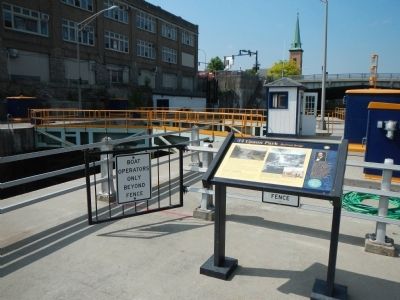
More about this marker. This marker is on the concrete island next to Locks 34 & 35.
The marker appear to have been relocated as the subjects of the plaque are not visible from its current location.
Credits. This page was last revised on June 16, 2016. It was originally submitted on September 6, 2014, by Barry Swackhamer of Brentwood, California. This page has been viewed 647 times since then and 52 times this year. Photos: 1, 2, 3, 4. submitted on September 6, 2014, by Barry Swackhamer of Brentwood, California. • Bill Pfingsten was the editor who published this page.


