Beaufort in Carteret County, North Carolina — The American South (South Atlantic)
Beaufort
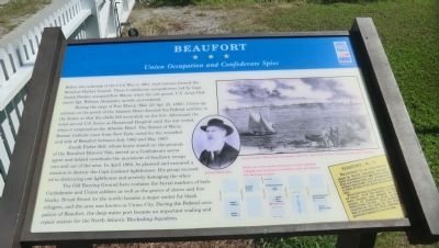
Union Occupation and Confederate Spies
During the siege of Fort Macon (Mar. 23-Apr. 25, 1862), Union signalman on the porch of the Atlantic Hotel directed the Federal artillery in the dunes so that the shells fell accurately on the fort. Afterward, the hotel served U.S. forces as Hammond Hospital until the war ended, then it reopened as the Atlantic Hotel. The Sisters of Mercy, Roman Catholic nuns from New York, cared for the wounded and sick of Beaufort between July 1862 and May 1863.
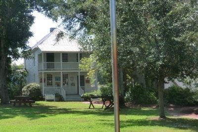
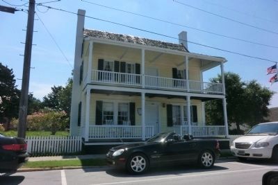
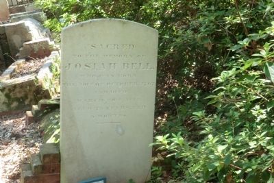
Josiah Fisher Bell, whose house stands on the grounds of the Beaufort Historic Site, served as a Confederate secret agent and helped coordinate the movement of Southern troops into and out of the area. In April 1864, he planned and executed a mission to destroy the Cape Lookout lighthouse. His group succeeded in destroying one lighthouse and severely damaging the other.
The Old Burying Ground here contains the burial markers of both Confederate and Union soldiers as well as the graves of slaves and free blacks. Broad Street (to the north) became a major center for black refugees, and the area was known as Union City. During the Federal occupation of Beaufort, the deep-water port became an important coaling and repair station for the North Atlantic Blockading Squadron.
(sidebar)
Beaufort, N.C.-Beaufort is an important place in North Carolina, periodically threatened by the rebels, who fret and fume over our possession of their sea coast. Our sketch gives a view of Beaufort, from Morehead city.
Beaufort was, in other days, a port of entry. It is the capital of Carteret county, and stands as the mouth of Newport river, a few miles from the sea. The harbor is considered the best in the state and is defended by Fort Macon, and gallantly taken by our forces.
(captions)
(center) Josiah Fisher Bell
(upper right) Frank Leslie’s Illustrated Newspaper, April 28, 1862. View of Fort Macon and Beaufort Harbor.
(lower right) Below are a few points of interest. A more detailed walking tour brochure is available inside the Historic Site Welcome Center.
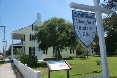
Erected by North Carolina Civil War Trails.
Topics and series. This historical marker is listed in these topic lists: Cemeteries & Burial Sites • War, US Civil • Waterways & Vessels. In addition, it is included in the North Carolina Civil War Trails series list. A significant historical month for this entry is April 1864.
Location. 34° 43.065′ N, 76° 39.916′ W. Marker is in Beaufort, North Carolina, in Carteret County. Marker is on Turner Street north of Middle Lane, on the right when traveling north. The marker is on the grounds of the Beaufort Historic Site. Touch for map. Marker is at or near this postal address: 130 Turner Street, Beaufort NC 28516, United States of America. Touch for directions.
Other nearby markers. At least 8 other markers are within walking distance of this marker. USS Monitor: America's First Ironclad (about 400 feet away, measured in a direct line); Old Burying Ground (about 400 feet away); Michael John Smith (about 500 feet away); John G. Newton (about 500 feet away); Remembering our Ancestors (about 600 feet away); Jacob Henry (about 600 feet away); Our Confederate Heroes (approx. 0.2 miles away); Whale Fishery (approx. 0.2 miles away). Touch for a list and map of all markers in Beaufort.
Also see . . . Beaufort Historic Site. (Submitted on September 10, 2014.)
Credits. This page was last revised on June 16, 2016. It was originally submitted on September 10, 2014, by Don Morfe of Baltimore, Maryland. This page has been viewed 686 times since then and 30 times this year. Photos: 1, 2, 3, 4, 5. submitted on September 10, 2014, by Don Morfe of Baltimore, Maryland. • Bernard Fisher was the editor who published this page.
