Atlantic Beach in Carteret County, North Carolina — The American South (South Atlantic)
Bogue Banks Lighthouse
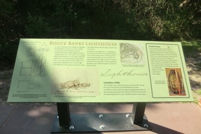
In order to promote safe navigation of shipping through Beaufort Inlet past numerous shoals and sand bars, the US Lighthouse Board established the Bogue Banks Lighthouse and a navigational beacon on the eastern end of Bogue Banks near Fort Macon in 1855. Built under the supervision of the Army Engineer Department about 200 yards northwest of Fort Macon, the Bogue Banks Lighthouse was a 50-foot high brick lighthouse with a beacon that shone twelve and a half nautical miles through a fourth order Fresnel lens.
In addition to the lighthouse, a navigational beacon was built on the south slope of the fort on a 30-foot wooden tower. The beacon had a sixth order Fresnel lens and was visible 10.6 nautical miles. Both lights provided a range by which mariners were able to take navigational bearings to pass safely through the channel of Beaufort Inlet.
Casualties of War
The two lights were in service for seven years until 1862. During the siege of Fort Macon in the War Between the States, Confederate soldiers of the fortís garrison toppled both towers to the ground because they stood in the way of the fortís cannons for the impending battle. No traces of either structure remain today.
(sidebar)
Fresnel Lenses
French engineer Augustin-Jean Fresnel (1788-1827) invented a system of lenses for lighthouses that became an industry standard in Europe and North America. The lenses resembled beehives and consisted of dozens of glass prisms arranged to bend and focus the light of old lanterns into projecting beams of light visible for miles. The lenses were arranged into different sizes, or orders, from the massive first order lens over eight feet tall for coastal lighthouses, down to small sixth order lens, seventeen inches tall, for harbor lights.
(caption) A fourth Order Fresnel lens, which was the size used in the Bogue Banks Lighthouse.
(captions)
(left) The original plans of the Bogue Banks Lighthouse called for a circular brick tower 50 feet high. When actually built during 1854-55, the tower was made in an octagon shape rather than circular.
(center) An 1862 sketch made by a Union soldier shows the ruined lighthouse after it was destroyed by Fort Maconís Confederate soldiers.
(right) The locations of the Bogue Banks Lighthouse and Beacon as shown on the 1857 Coast and Geodetic Survey Chart.
Topics and series. This historical marker is listed in these topic lists: Forts and Castles • War, US Civil • Waterways & Vessels. In addition, it is included in the Lighthouses series list. A significant historical year for this entry is 1855.
Location. 34° 41.814′ N, 76° 40.698′ W. Marker is in Atlantic Beach, North Carolina, in Carteret County. Marker can be reached from East Fort Macon Road (County Route 1190) 3.6 miles east of Atlantic Beach Causeway (County Route 1182). The marker is located on the grounds of Fort Macon State Park. Touch for map. Marker is at or near this postal address: 2303 East Fort Macon Road, Atlantic Beach NC 28512, United States of America. Touch for directions.
Other nearby markers. At least 8 other markers are within walking distance of this marker. Cistern (a few steps from this marker); Officers Quarters at Fort Macon (within shouting distance of this marker); 30-Pounder Parrott Rifle (within shouting distance of this marker); Queens Anne's Revenge (within shouting distance of this marker); The Military Post of Fort Macon in the Nineteenth Century (within shouting distance of this marker); Fort Macon in the 1920s and 1930s (within shouting distance of this marker); World War II Barracks Area (within shouting distance of this marker); Welcome to Fort Macon (within shouting distance of this marker). Touch for a list and map of all markers in Atlantic Beach.
Also see . . . Fort Macon State Park. N.C. Division of Parks & Recreation (Submitted on September 15, 2014.)
Credits. This page was last revised on June 16, 2016. It was originally submitted on September 13, 2014, by Don Morfe of Baltimore, Maryland. This page has been viewed 650 times since then and 60 times this year. Photo 1. submitted on September 13, 2014, by Don Morfe of Baltimore, Maryland. • Bernard Fisher was the editor who published this page.
Editor’s want-list for this marker. A wide shot of the marker and its surroundings. • Can you help?
