Fort Lee in Bergen County, New Jersey — The American Northeast (Mid-Atlantic)
Protection of the Hudson River
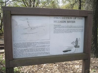
On July 12th, 1776, the British warships Phoenix and Rose sailed beneath the unarmed Bluff Rock, later named Fort Lee. This provocative action led Congress to order General Washington “By every art and whatever expense to obstruct effectively the navigation of the river.”
Washington soon adopted General Putnam’s plan for blockading the river by sinking stone-filled ships’ hulls chained together with protruding jagged spikes.
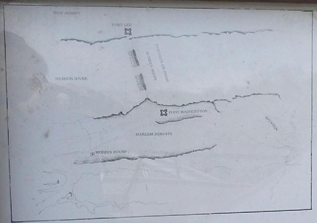
A series of ships was sunk, joined stern to stern 70 feet apart with three or more iron tipped, spiked logs fastened to each hull. The hulls were submerged just beneath the water so that the spiked logs became turned upward to expose their menacing hazards to passing ships, forming a 280-foot sub-surface barrier.
Although a fast-moving frigate might successfully pierce the blockade, damage to the vessel could be extensive. Just as importantly, ships attempting to pass would at least be slowed giving gunners on the river’s heights and opportunity to aim broadside fire at their targets.
Chevaux-De-Frise
On the night of August 4th, General Mifflin’s troops at Fort Washington worked on river obstructions when “Four ships, chained and boomed, with a number of amazing large Chevaux-De-Frise, were carefully sunk close by the fort.”
“Chevaux-De-Frise” describes the field emplacements used by horseless, 16th century Dutch warriors who stopped the mounted Spanish army at Friesland using trees fashioned into spikes with jagged-edged sides. The Dutch called these implements of war, “The Horses of Friesland.” Translated by the French, they became known as the “Chevaux-De-Frise.”
Erected by Fort Lee Historic Park.
Topics and series. This historical marker is listed in these topic lists: Forts and Castles • Notable Places • War, US Revolutionary. In addition, it is included in the Former U.S. Presidents: #01 George Washington series list. A significant historical date for this entry is July 12, 1776.
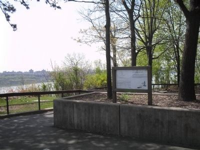
Location. 40° 51.153′ N, 73° 57.651′ W. Marker is in Fort Lee, New Jersey, in Bergen County. Marker is in Fort Lee Historic Park on a walking trail at the northernmost part of the park. Touch for map. Marker is in this post office area: Fort Lee NJ 07024, United States of America. Touch for directions.
Other nearby markers. At least 8 other markers are within walking distance of this marker. Fort Lee Historic Park (about 700 feet away, measured in a direct line); Palisades Interstate Park (approx. 0.2 miles away); Mortar Battery (approx. 0.2 miles away); Military Magazine (approx. ¼ mile away); The American Crisis (approx. ¼ mile away); Washington’s Retreat to Victory
(approx. 0.3 miles away); Abatis Construction at Fort Lee (approx. 0.3 miles away); Musketry Breastwork (approx. 0.3 miles away). Touch for a list and map of all markers in Fort Lee.
More about this marker. The upper left of the marker contains a map showing Forts Lee and Washington and the line of Chevaux-De-Frise of sunken ships spanning the Hudson River.
The bottom right of the marker shows a ship approaching a Chevaux-De-Frise underwater obstacle.
Related markers. Click here for a list of markers that are related to this marker. This series of markers follows the walking tour of Fort Lee Historic Park.
Also see . . . Battle of Fort Washington. Wikipedia entry (Submitted on February 2, 2021, by Larry Gertner of New York, New York.)
Credits. This page was last revised on February 2, 2021. It was originally submitted on May 15, 2008, by Bill Coughlin of Woodland Park, New Jersey. This page has been viewed 2,129 times since then and 35 times this year. Photos: 1, 2, 3, 4. submitted on May 15, 2008, by Bill Coughlin of Woodland Park, New Jersey. • Christopher Busta-Peck was the editor who published this page.


