La Porte in LaPorte County, Indiana — The American Midwest (Great Lakes)
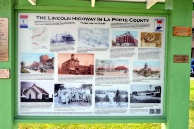
The Lincoln Highway in La Porte County
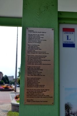
"Through the Door"
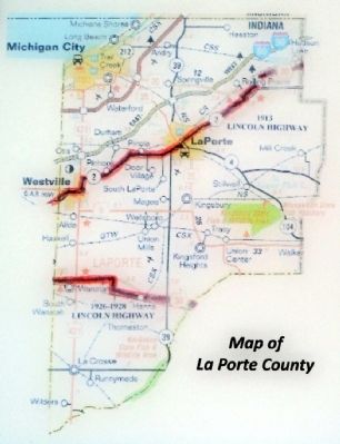
La Porte County became the second largest county in geographic area (608 square miles) in Indiana and was organized in 1832. Fur traders and early settlers used the Sauk Trail that had been created by Native Americans who lived in and traveled through this area.
(Paraphrased from Jan Shupert-Arick’s book The Lincoln Highway Across Indiana.)
(Top Row Image Captions from left to right)
Bob’s Bar-B-Q - Beginning in the 1920's Bob’s Bar-B-Q was a popular stop on the Lincoln Highway and is one that is still remembered by the local old timers. Located near the junction of Indiana 2 (Lincoln Highway) and U.S. 20 in Rolling Prairie, it remains a busy eatery. Now known as Jennie Rae’s, the slogan is “Where our family meets yours.”
(Courtesy Jennie Rae’s)
Downtown La Porte, 1954 The American Restaurant, now B&J’s American Café at 607 Lincoln Way, was built in 1915. The restaurant continues to be a favorite stop for Lincoln Highway tourists. The café has been owned by the Pappas family for 90 years.
(Courtesy John Pappas)
The Hotel Rumely, 800 Michigan Avenue, is now the restored Rumely Historic Apartments. Built in 1912, the 100 room hotel opened in 1913. It was a popular overnight stay for Lincoln Highway travelers. According to an advertisement in the 1915 Complete Official Road Guide of the Lincoln Highway the rooms were fireproof, modern throughout, and used the European plan with rates of $1.00 and up. Rooms with baths were $1.50 and up. “Special Attention Given to Automobile Parties”.
(Courtesy Russell Rein.)
Lincoln Highway Day in La Porte, June 25, 1915. The Lincoln Highway Association made a film of scenes along the Lincoln Highway and La Porte was one of 65 cities represented. The thousands of people attending witnessed the greatest industrial parade in the history of La Porte. After the parade, LH Field Secretary H.C. Ostermann selected Miss Dorothy Dolan as the prettiest girl from the La Porte Bay Tree Inn basketball team float. Dorothy is pictured riding in the official Lincoln Highway Car, a Stutz.
(Courtesy John Pappas)
(Middle Row Image Captions from left to right)
The Interurban (Northern Indiana Railway) was the means of travel that used trolley or street cars. The interurban ran down Main Street (now Lincoln Way) in La Porte from 1902 to 1934. The street cars connected
La Porte with Michigan City, South Bend and beyond. The automobile brought about its demise. Note the blankets covering the auto radiators.
(Courtesy La Porte County Historical Society)
Munson Company Today a hybrid car is viewed as a new innovation. However America’s first gasoline-electric hybrid was built on April 25, 1898 by the Munson Company of La Porte. The factory was located on the corner of Michigan Avenue and Washington Street. The “horseless carriage” was produced here between 1896 and 1902. Only four Munson automobiles were manufactured in La Porte.
(Courtesy Dennis Horvath, Photo, La Porte County Historical Society.)
The Current New York Central Depot was built to take the place of the Lake Shore and Michigan Southern Depot that burned in 1907. It was constructed by Lawson and Danielson in 1909-10, with a passenger/ticket office and a baggage express building. The platform with a roof in between the buildings was added later. A tunnel was built between the buildings to convey the baggage. The depot was restored and dedicated in 2009. It is now the home of the La Porte Chamber of Commerce and the Economic Development Corporation.
(Courtesy La Porte County Historical Society.)
The La Porte County Courthouse. Two courthouses have been built on this site prior to the present one, built in
1892-94. It is built of Lake Superior red sandstone.
(Courtesy La Porte County Historical Society)
(Bottom Row Image Captions from left to right)
Pinhook Methodist Church Located west of La Porte on State Road 2, this church was built on an old Indian trail that became part of the Lincoln Highway in 1913. Erected in 1847, the church was built out of hand-hewn walnut logs. Originally the front entry had two door openings, one for men and one for the women. Restored in 1989, the church is the oldest church building in La Porte County and was listed on the National Register of Historic Places in 2009.
(Courtesy Phyllis Marks.)
Westville Lincoln Highway Baseball Team John Jerome was born in 1885 and was a member of the team called “Lincoln Highway” because players lived in and around Westville on the Lincoln Highway. At that time (1915) there were many local ball teams.
(Courtesy Mike Fleming, Westville Historical Society)
At the Monon Railroad (removed) site in downtown Westville, at Lincoln funeral marker, the La Porte County Parks Department is planning a bike and walking trail. The trail leading north will be called the Lincoln Memorial Trail. It will continue to Michigan City and Lake Michigan with other names, providing many parking trail heads.
(Courtesy Jim Bevins.)
Wanatah
This image captures a view of the Richman House in 1893. The house still stands today at 10351 W. U.S. 30. William and Augusta Richman raised 9 children here. William was the president of the Wanatah State Bank and a prosperous farmer. This house sat just north of the original Lincoln Highway until it was moved further north when the Lincoln Highway, (by then U.S. 30) was made a 4-lane highway.
(Courtesy Wanatah Historical Society)
Hanna This photo is of Hanna’s principal business section at the corner of West Street (old Lincoln Highway) and Thompson Street in the early 1900's. Shown are the Denison and the Grieger Bros. store buildings.
(Courtesy Hanna Historical Society)
Topics and series. This historical marker is listed in these topic lists: Railroads & Streetcars • Roads & Vehicles • Settlements & Settlers. In addition, it is included in the Lincoln Highway series list. A significant historical month for this entry is April 1870.
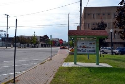
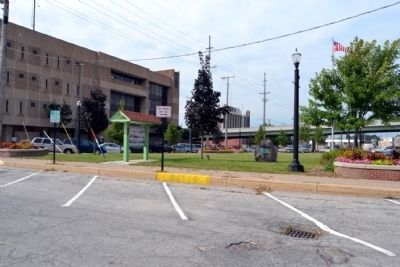
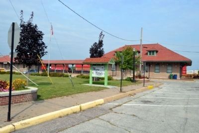
Location. 41° 36.767′ N, 86° 43.382′ W. Marker is in La Porte, Indiana, in LaPorte County. Marker can be reached from the intersection of Michigan Avenue and Washington Street, on the left when traveling north. Marker is located on the lawn south of the Greater La Porte Chamber of Commerce in the historic train depot. Touch for map. Marker is at or near this postal address: 803 Washington St, La Porte IN 46350, United States of America. Touch for directions.
Other nearby markers.
At least 8 other markers are within walking distance of this marker. The Lincoln Highway (here, next to this marker); First Log Cabin in LaPorte (a few steps from this marker); World War Memorial Tree LaPorte County (Indiana) (about 500 feet away, measured in a direct line); American Revolutionary Bicentennial (about 600 feet away); LaPorte County Courthouse (about 700 feet away); Historic Etropal Theatre (about 800 feet away); Long Live La Porte (approx. 0.2 miles away); Meinrad Rumely (approx. 0.2 miles away). Touch for a list and map of all markers in La Porte.
Also see . . .
1. The Lincoln Highway Association. Official website of the Lincoln Highway Association. (Submitted on September 17, 2014.)
2. Indiana Lincoln Highway Byway. Official website of the Indiana Lincoln Highway Association. (Submitted on September 17, 2014.)
Credits. This page was last revised on June 16, 2016. It was originally submitted on September 17, 2014, by Duane Hall of Abilene, Texas. This page has been viewed 785 times since then and 55 times this year. Photos: 1, 2, 3, 4, 5, 6. submitted on September 17, 2014, by Duane Hall of Abilene, Texas.
