Near Algoma in Kewaunee County, Wisconsin — The American Midwest (Great Lakes)
The Kewaunee County Farm
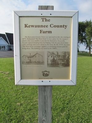
The Kewaunee County Farm was operated on this site starting in 1879. Nicknamed 'The Poor Farm' it was a place for the county's elderly who were unable to provide for themselves financially. Tenants enjoyed keeping busy by helping with the pure-bred dairy cattle and hogs that were raised on the farm. By the 1970's the term 'The Poor Farm' no longer applied, as remaining tenants paid for living there. The building was razed in the 1980's.
Erected 1996 by the Kewaunee County Historical Society.
Topics. This historical marker is listed in this topic list: Notable Places. A significant historical year for this entry is 1879.
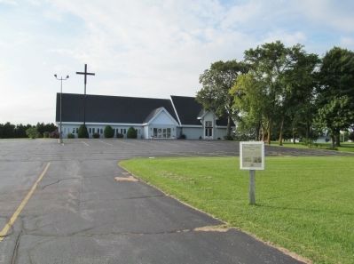
Location. 44° 32.002′ N, 87° 30.089′ W. Marker is near Algoma, Wisconsin, in Kewaunee County. Marker is on State Highway 42 south of Fifth Road, on the right when traveling south. Marker is along the entrance to the parking lot of Grace Lutheran Church; approximately 5 driving miles south of Algoma, or approximately 5 driving miles north of Kewaunee. Touch for map. Marker is at or near this postal address: N5789 State Highway 42, Kewaunee WI 54216, United States of America. Touch for directions.
Other nearby markers. At least 8 other markers are within 6 miles of this marker, measured as the crow flies. The Kewaunee County Piers (approx. 3.1 miles away); Kewaunee Marsh Arsenic Spill Area (approx. 4.1 miles away); Barge "Emerald" (approx. 4.7 miles away); Father Marquette (approx. 4.7 miles away); Car – Ferry Service (approx. 5.1 miles away); Early History of Kewaunee (approx. 5.1 miles away); The Great Kewaunee Fire (approx. 5.2 miles away); Civil War and Cuban Veterans Monument (approx. 5.3 miles away).
More about this marker.
photo captions:
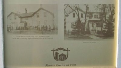
• Picture of Kewaunee County Farm and Home 1894 · Mr. & Mrs. Schmeling, Superintendent and Wife are Encircled
• Back View of Home
Credits. This page was last revised on June 16, 2016. It was originally submitted on September 19, 2014, by Keith L of Wisconsin Rapids, Wisconsin. This page has been viewed 388 times since then and 10 times this year. Photos: 1, 2, 3. submitted on September 19, 2014, by Keith L of Wisconsin Rapids, Wisconsin.


