Mount Olive in Wayne County, North Carolina — The American South (South Atlantic)
Mount Olive
Garrard's Raid
ó Foster's Raid ó
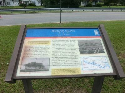
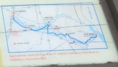
Late in 1862, Union Gen. John G. Fosterís garrison was well entrenched in New Bern and made several incursions into the countryside. On December 11, Foster led a raid from New Bern to burn the Wilmington and Weldon Railroad Bridge over the Neuse River at Goldsboro and to demonstrate in support of Gen. Ambrose E. Burnsideís attack at Fredericksburg, Virginia. Fosterís force consisted of 10,000 infantry, 650 cavalry and 40 cannons.
(main text)
After capturing Kinston on December 14, 1862, Foster marched to Whitehall, where he fought an engagement on the morning of December 16. He also dispatched Maj. Jeptha Garrard with 500 cavalrymen of the 23rd New York Artillery to strike Mount Olive station on the Wilmington and Weldon Railroad here. Garrardís mission was to destroy the depot and as much of the railroad here as possible. Arriving in Mount Olive about 3:00 p.m., Garrard found the ticket agent selling tickets, passengers loitering about the station, mail lying on the platform, and a few paroled prisoners awaiting transport to Wilmington.
Gerrard and his men arrested stationmaster Lemuel W. Kornegay and all the bystanders and cut the telegraph wires. Two companies rode seven miles south, destroyed track in several places set fire to the rail ties to bend the rails, and burned the trestle and bridge over Goshen Swamp near Faison. Another company rode almost four miles toward Goldsboro, where it ambushed the mail train and put three artillery shells into it as it backed out of range. Before leaving Mount Olive about 8:00 p.m. to rejoin Fosterís main force at Whitehall, Garrard burned the station here.
(sidebar)
At the time of Garrardís raid, Mount Olive had fewer than 100 residents, a post office, some frame stores and turpentine distilleries, and several houses. The village had been surveyed and platted in 1854, but Mount Olive was not incorporated as a town until March 1, 1870.
(captions)
(lower left) Mount Olive Depot (ca.1900) replaced late 1830ís depot burned by Maj. Jeptha Garrard in 1862.
(upper right) Destroying railroads included heating and “wrapping” the rails.
(lower right) Approximate route of Gen. John G. Foster's raid from New Bern to Goldsboro, December 1862
Erected by North Carolina Civil War Trails.
Topics and series. This historical marker is listed in these topic lists: Railroads & Streetcars • War, US Civil. In addition, it is included in the North Carolina Civil War Trails series list. A significant historical date for this entry is March 1, 1870.
Location. 35° 11.94′ N, 78° 3.855′
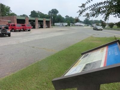
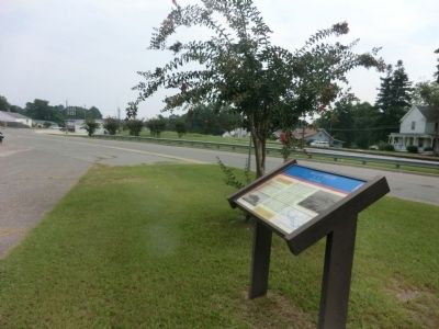
W. Marker is in Mount Olive, North Carolina, in Wayne County. Marker is at the intersection of Northwest Center Street (County Route 1938) and West College Street, on the left when traveling north on Northwest Center Street. Touch for map. Marker is at or near this postal address: 401 Northwest Center Street, Mount Olive NC 28365, United States of America. Touch for directions.
Other nearby markers. At least 8 other markers are within 13 miles of this marker, measured as the crow flies. Mount Olive College (approx. ĺ mile away); Samson L. Faison (approx. 6.9 miles away); Attack of the 17th Massachusetts (approx. 9.9 miles away); Battle of Goldsborough Bridge (approx. 9.9 miles away); Battle of Goldsboro Bridge (approx. 9.9 miles away); Union Assault on the Bridge (approx. 10 miles away); Confederate Counterattack (approx. 10 miles away); Waynesborough (approx. 12Ĺ miles away).
Credits. This page was last revised on June 16, 2016. It was originally submitted on September 20, 2014, by Don Morfe of Baltimore, Maryland. This page has been viewed 647 times since then and 38 times this year. Photos: 1, 2, 3, 4. submitted on September 20, 2014, by Don Morfe of Baltimore, Maryland. • Bernard Fisher was the editor who published this page.


